South Poplar CGI case studies for restoration, reuse and public realm
London E14 · Area Regeneration Study
This South Poplar page brings together several CGI case studies in London E14: aerial masterplan visuals, heritage restoration concepts, adaptive reuse interiors, historical progress CGI, estate landscape improvements and investor pitch imagery. The common thread is visual evidence for regeneration conversations, not a single masterplan-only project.
South Poplar visual case studies in London E14
The page is an area-based visual case-study collection for South Poplar. It uses public context, archive references and concept images to show what can be tested visually across streets, civic buildings, industrial interiors and council-estate landscapes, while avoiding claims about planning approval, delivery status or named project appointments.
South Poplar CGI case-study proof images
Aerial masterplan illustration 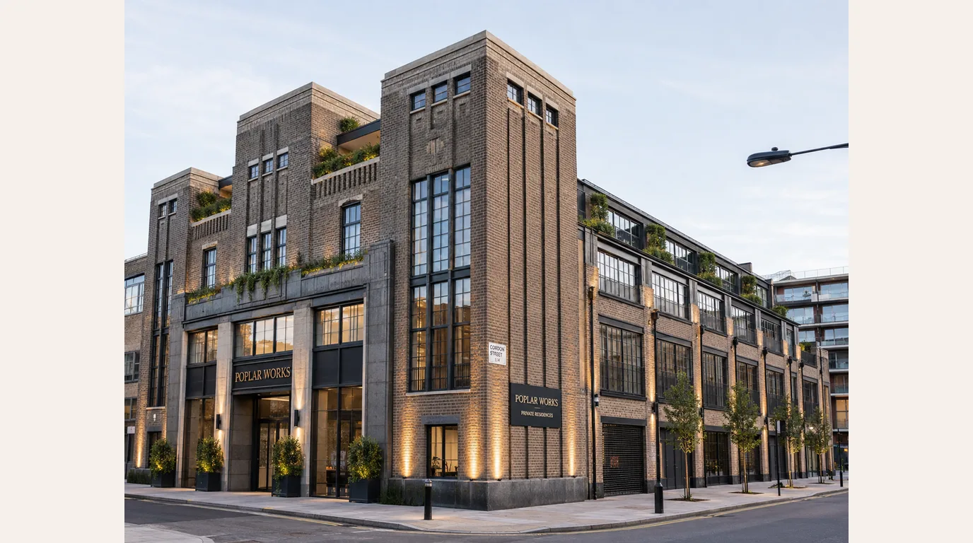 Restoration concept
 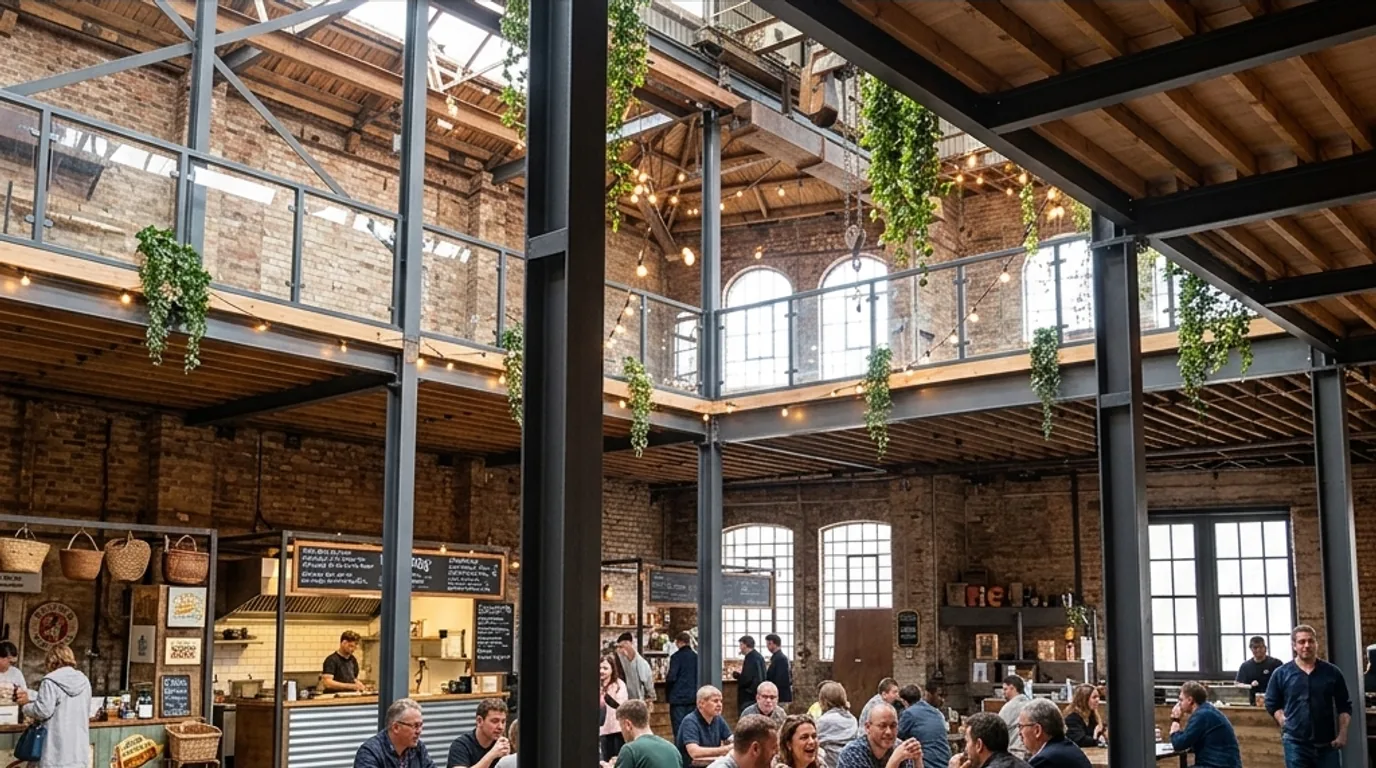 Adaptive reuse CGI
 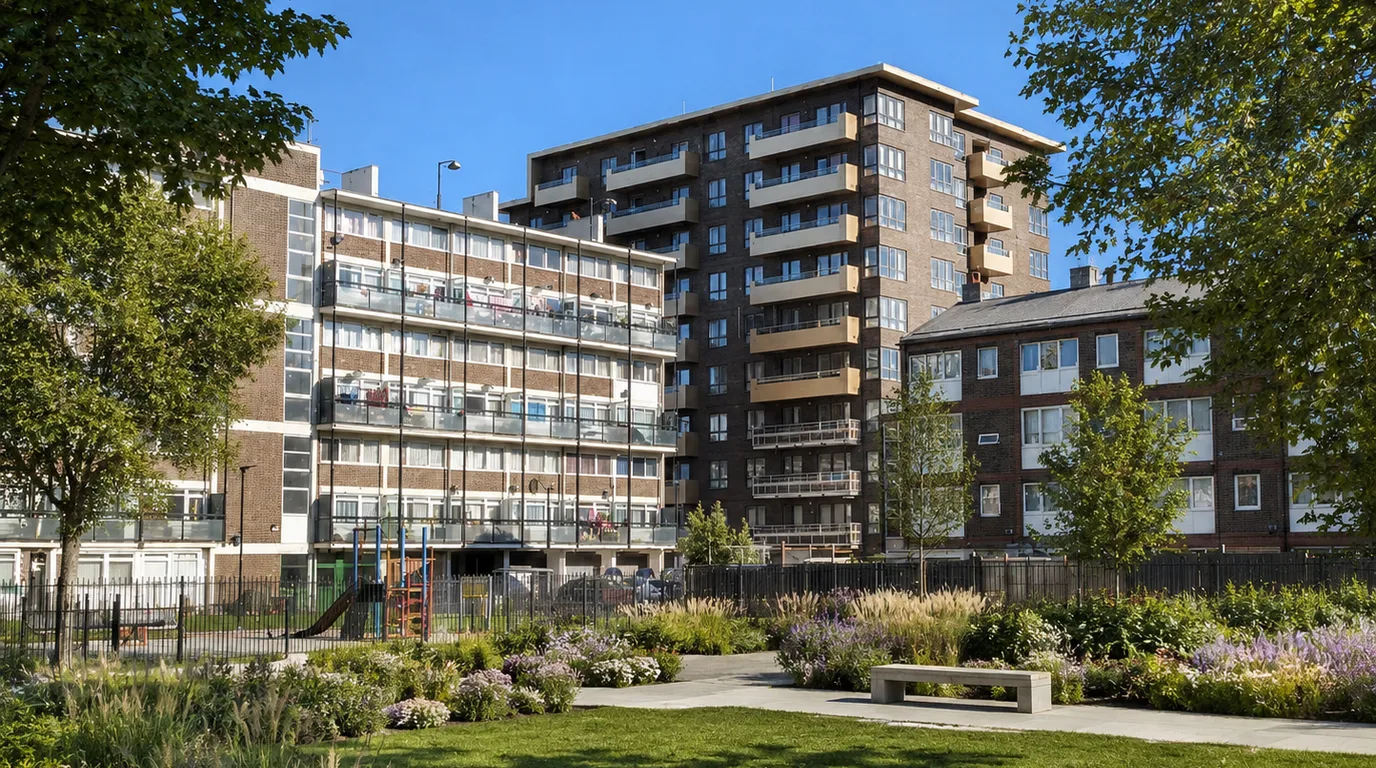 Estate landscape concept
 Use this proof set to read the South Poplar page before the longer context: district-scale aerial CGI, Poplar Public Baths restoration, warehouse adaptive reuse and St Matthias Estate landscape improvement. Together the images position London E14 as a group of visual case studies, not a single masterplan image.
The lower sections unpack each image as a separate CGI communication task: scale, reuse, historical comparison, estate renewal, mixed-use frontage and resident public realm. The visuals remain concept and viability evidence for stakeholder and investor conversations, not claims of approval, delivery or named appointments.
South Poplar and Billingsgate regeneration context
South Poplar sits in London E14, within the London Borough of Tower Hamlets and close to the Canary Wharf and Isle of Dogs development context. Public planning documents for the area discuss South Poplar, Billingsgate, North Quay, Aspen Way, movement, infrastructure and joined-up development, so visual explanation has to show relationships between sites rather than a single isolated building.
That public context matters because aerial CGI and masterplan visualisation are often used when a proposal has to be understood as a connected district. In this case the visuals were framed around long-term vision, phasing and public-realm quality, while leaving policy authorship, public consultation and planning conclusions to the appropriate project team and public bodies.
Poplar Public Baths restoration concept for Poplar Works
Poplar Public Baths is the heritage anchor in this Poplar High Street story. A 2011 SilverTiger blog record describes the baths as opened in 1852, later used for dancing and entertainment, closed and derelict despite listed status, with a council renovation plan already passed in March 2010. That makes it useful visual evidence for this page: the building carries memory, but the pitch needs to show what reuse could look like.
A derelict civic landmark becomes a viability story when the reuse is visible.
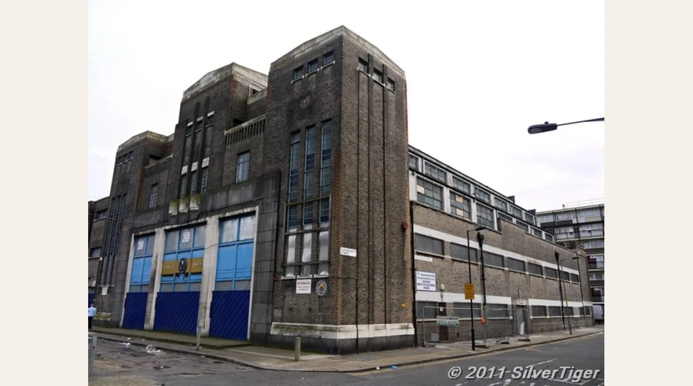 Before
 Before view: 2011 archive reference of Poplar Public Baths as a closed and derelict civic building.
After concept Concept view: restored brick, lit entrance, active frontage and residential repositioning shown as a viability pitch.
The after concept frames the derelict civic building as Poplar Works: repaired brick, active frontage, warmer entrance lighting, clearer signage, planting and residential use above. The story is a proof of viability for a developer or investor deck. It shows what is available and what is possible without claiming that the image is a planning approval, a construction record or a named architect appointment.
Warehouse hub adaptive reuse concept for South Poplar
The warehouse interior adds an inside-out proof point to the South Poplar regeneration story. The before image shows a vacant industrial shell with exposed steel, damaged surfaces, empty upper galleries and no clear public use. The concept image keeps the industrial frame and turns it into a warehouse hub with food counters, shared seating, mezzanine edges, hanging planting and warm interior lighting.
Adaptive reuse is easier to fund when the interior use is visible.
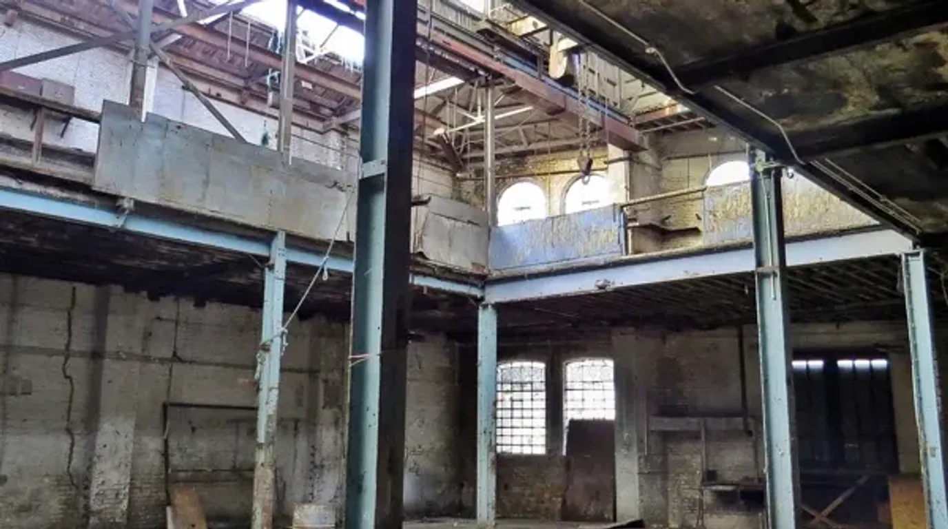 Before
 Existing condition: vacant warehouse shell with exposed structure, upper galleries and no active public use.
After concept Concept view: a retained industrial interior reimagined as a food, drink and community hub.
For a pitch deck, this kind of interior CGI does two jobs. It shows that a difficult shell can be read as a viable public-facing destination, and it helps investors, councils and estate stakeholders discuss activation, meanwhile use or long-term adaptive reuse without treating the image as a planning approval or completed scheme.
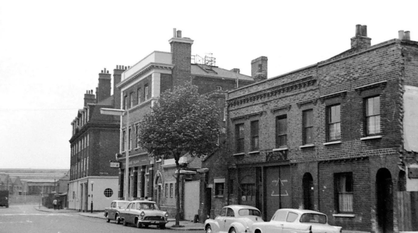
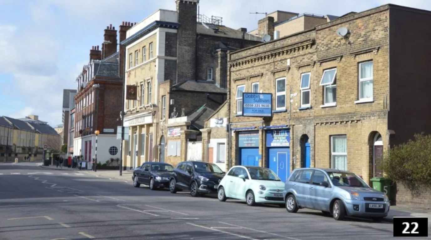
Historical restoration and progress CGI for Poplar High Street
The historical sequence gives the South Poplar page a different kind of proof: not only what a single building could become, but how a street frontage can be read across time. The 1968 archive reference, the 1990s street condition and the 2026 restoration CGI keep the same camera logic so the viewer can compare massing, shopfronts, window rhythm, roof additions and street activity without needing a technical drawing first.
Progress CGI makes change legible across decades.
 1968
1968 Archive reference: brick frontage, older shopfronts and a quieter street edge before later alteration.
 1990s
1990s Later condition: retained fabric, changed shopfronts, parked cars and a less coherent commercial frontage.
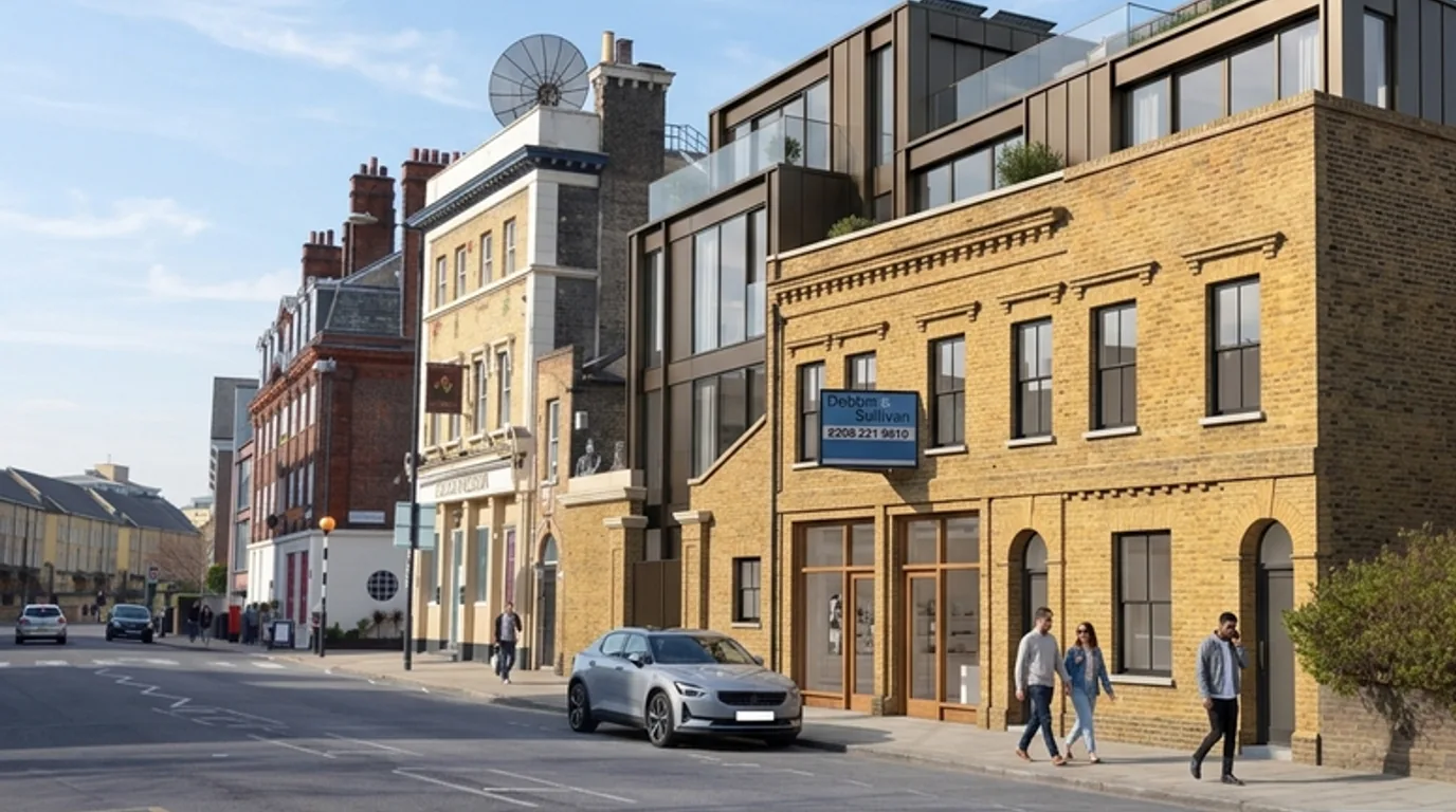 2026 CGI
 Progress CGI: retained brickwork, repaired openings, active entrances and new upper accommodation shown as a concept.
For an investor or council-facing pack, this is useful because it turns restoration into a visual argument. The CGI does not claim a completed scheme. It shows a credible progress route: retain the historic brick frontage, repair the ground-floor openings, introduce contemporary upper accommodation and make the active street edge easier to understand.
Lubbock House viability concept for Poplar High Street
Lubbock House on Poplar High Street gives the South Poplar story a smaller building-scale test inside the wider regeneration context. Public housing history sources identify Lubbock and Martindale Houses as mid-century, lower-rise blocks in the Galloway Estate context, but this page treats Lubbock House as a concept visualisation exercise, not as a claim about a submitted scheme, planning approval or named future architect.
Proof of viability, not a planning claim.
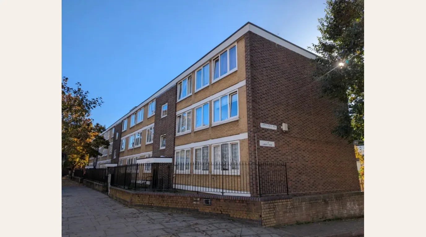 Before
 Existing condition: Lubbock House read from Poplar High Street before the visual feasibility treatment.
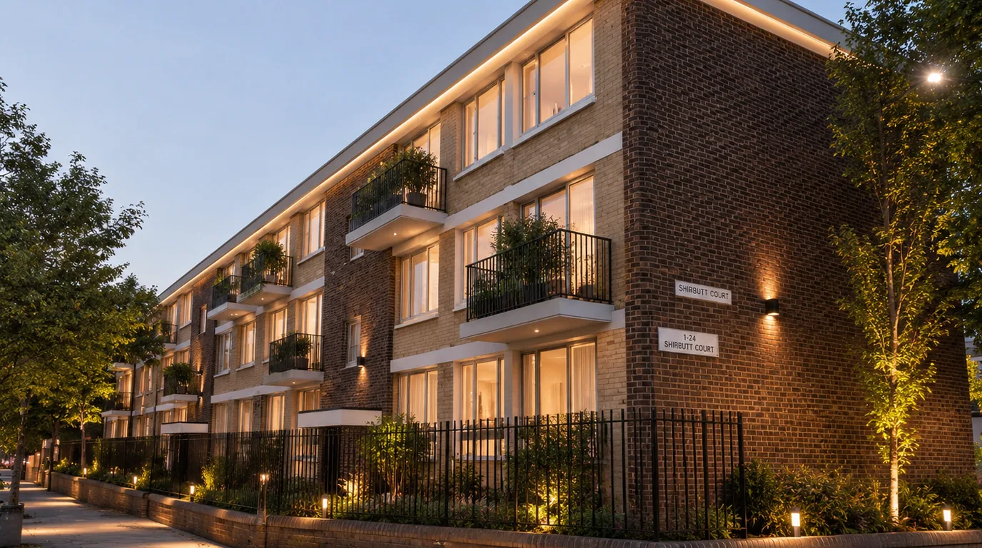 After concept
 Concept view: a proof of viability image for pitch, review and early investment conversations.
The before and after pair shows how a modest existing block could be presented for an investor pitch deck or early development review: cleaned brick, warmer entrances, clearer frontage, balcony planting, evening lighting and landscape improvements. The point is proof of viability. CGI lets a team test whether refurbishment, public-realm upgrade and residential repositioning can be understood from one street-level view before design commitments are fixed.
Martindale House viability concept for Poplar High Street
Martindale House, as part of the Galloway Estate context, provides another building-scale viability test for Poplar High Street. This section demonstrates how a dilapidated or abandoned block can be visually revitalized to communicate refurbishment potential to planning authorities and investment partners.
Visual feasibility for street-level estate refurbishment.
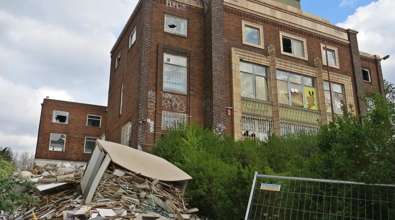 Before
 Existing condition: Martindale House showing severe dilapidation, graffiti and site debris.
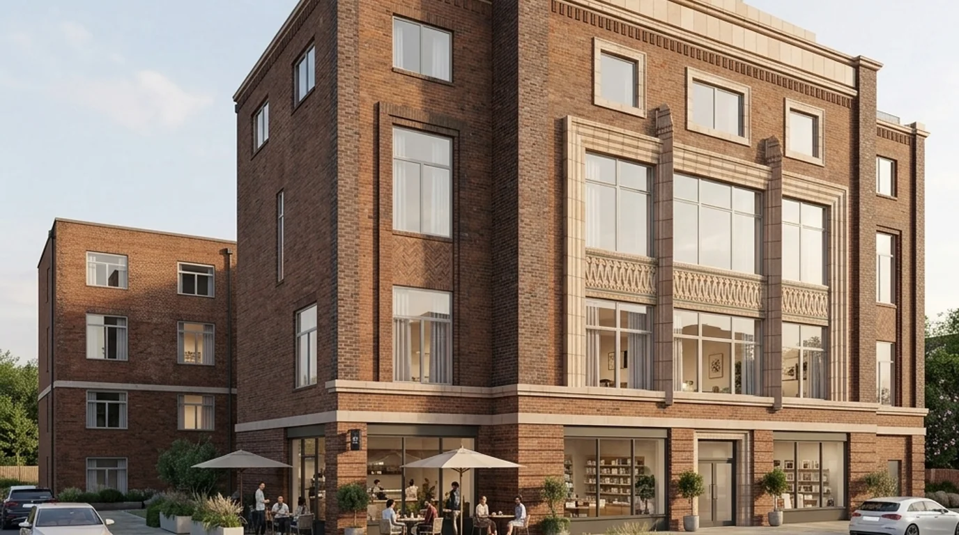 After concept
 Refurbished concept: revived facade, active street frontage, and clean public realm landscaping.
The before and after comparison shows the complete transformation: clearing away the active site debris, rubble, and temporary construction fencing, replacing overgrown bushes with high-quality street paving and courtyard landscaping, and completely restoring the brick facade. The concept introduces a ground-floor café and small business frontage beneath refurbished residential apartments.
Limestone Poplar redevelopment concept for Poplar High Street
This concept illustrates the visual feasibility of redeveloping a prominent derelict site in South Poplar. The proposal keeps the original Tudor-style half-timbered facade on the left completely restored and renovated, returning the structure to its historical design with clean white plaster and freshly painted black timbers.
Combining heritage restoration with contemporary residential extension.
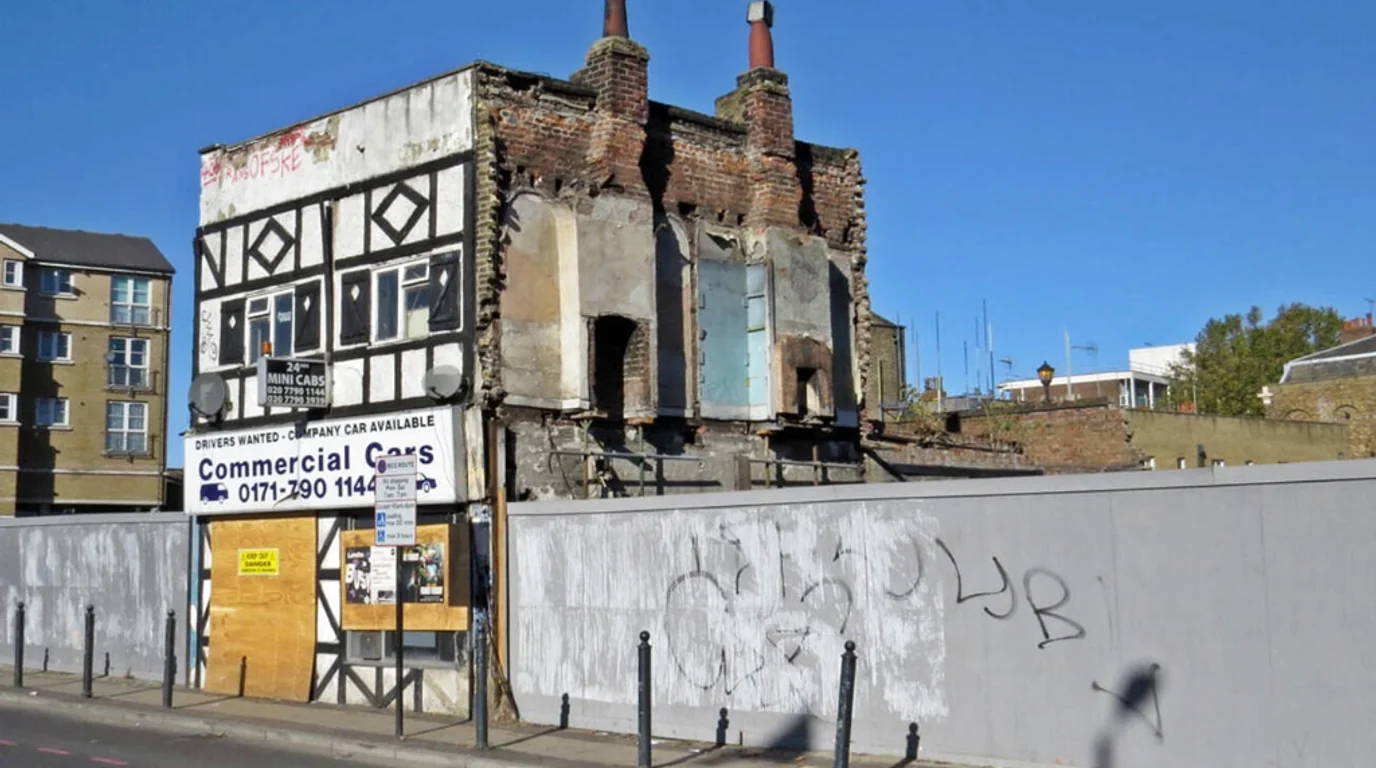 Before
 Existing condition: Derelict building with exposed chimneys and construction hoardings.
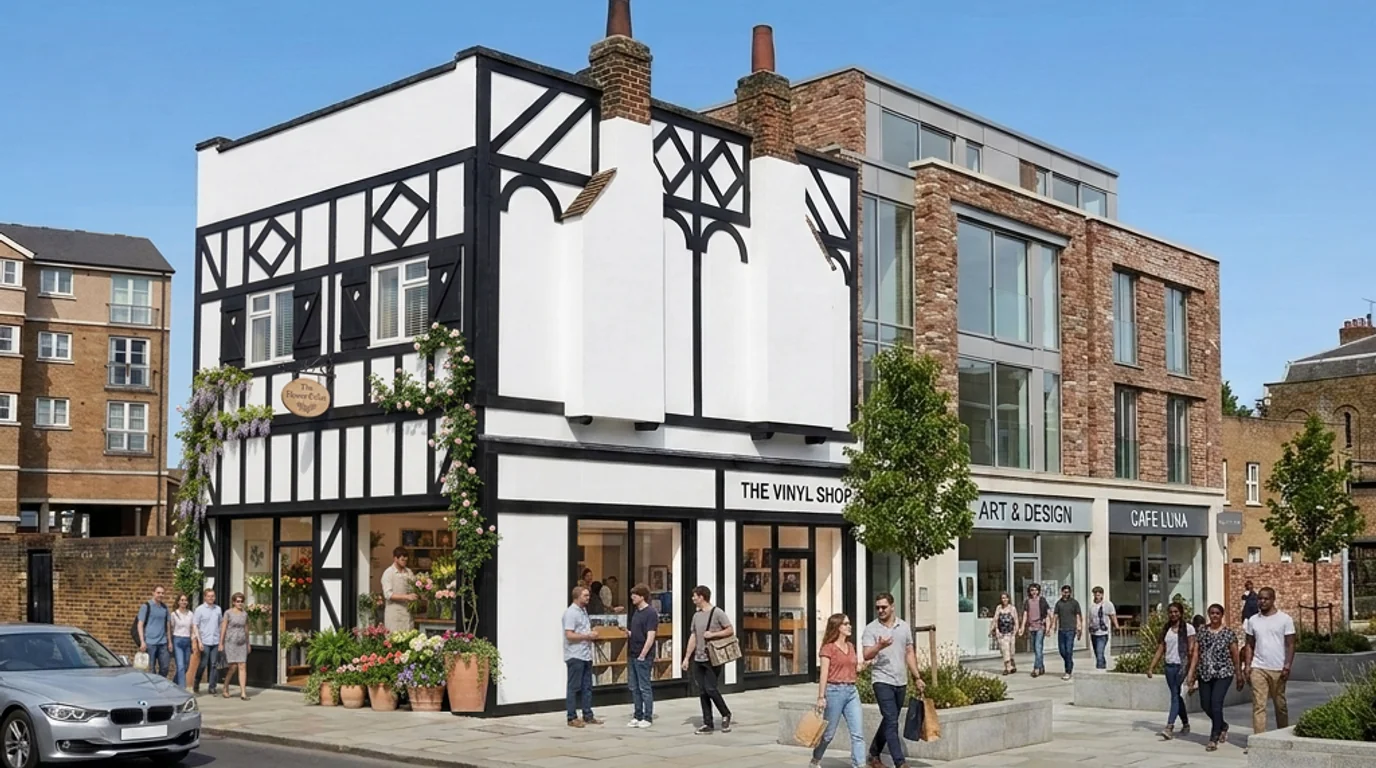 After concept
 Redevelopment concept: restored facade, brand-new residential extension, and active street-level storefronts.
On the right-hand side, the exposed, demolished structure is replaced with a brand-new contemporary brick residential block extension, perfectly aligned to match the original building structure and perspective lines. The ground floor underneath this extension features two small business storefronts, with a clean and beautifully paved streetscape in place of the old construction hoarding.
St Matthias Estate landscape regeneration concept for Cottage Street
St Matthias Estate sits along Cottage Street, briefly fronting Poplar High Street and stretching towards East India Dock Road. The estate context is not only a background for an architectural view. Public reporting around Randall House has described Grenfell-style flammable ACM cladding concerns and continuing remediation pressure, so any regeneration pitch has to show resident benefit, building-safety awareness and public-realm improvement in one story.
For estate regeneration, the landscape is resident infrastructure.
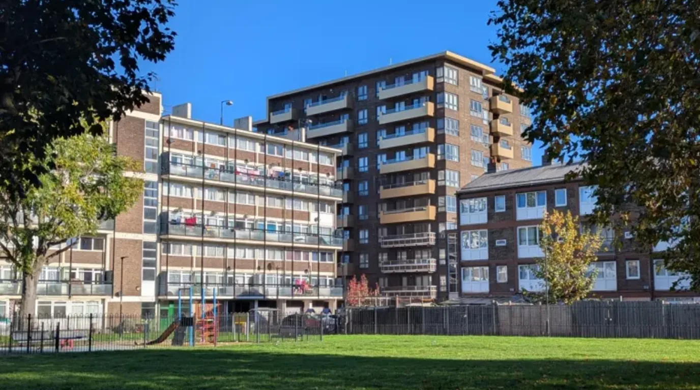 Before
 Existing condition: St Matthias Estate seen from the green space by Cottage Street, with Storey House to the left and Randall House behind.
After concept Concept view: resident landscape, planting, paths and seating shown as an early investor and council-estate improvement pitch.
The concept view turns the open grass and fenced play space into a resident-focused landscape: layered planting, accessible paths, seating, retained play, softer edges and a calmer green foreground for the surrounding council estate. It is framed as an investor and council-estate improvement visual for residents, showing how landscape work could support everyday use while the wider estate addresses frontage, safety and public-realm questions.
The visual challenge: scale, reuse and public-realm clarity
The visual challenge was to make a large regeneration story legible without flattening it into a diagram. Aerial CGI had to show massing, routes and public-space structure, while the building and estate studies had to show what restoration, reuse and public-realm improvement could feel like at human scale.
The constraint is that South Poplar is not read as one finished object. Stakeholders need to compare early references, existing conditions and possible future states across several sites, then understand how routes, active edges, landscape and retained fabric could work together.
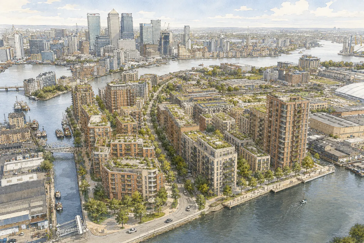
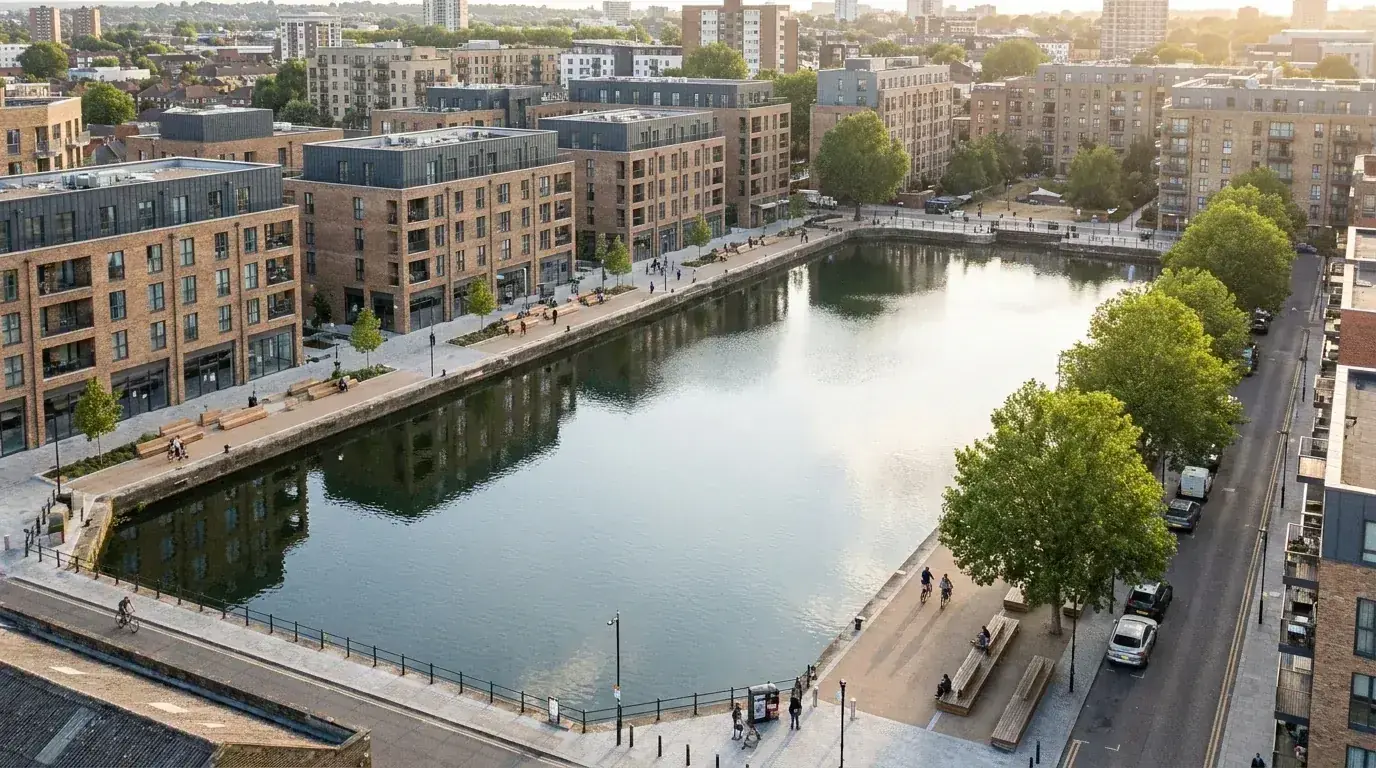
Wide aerial views for the masterplan story
The three aerial views gave the project team a way to discuss South Poplar at district scale. Wide views are useful when block layout, open-space sequence, routes, public realm and surrounding landmarks need to be seen together instead of separated into plan drawings and presentation diagrams.
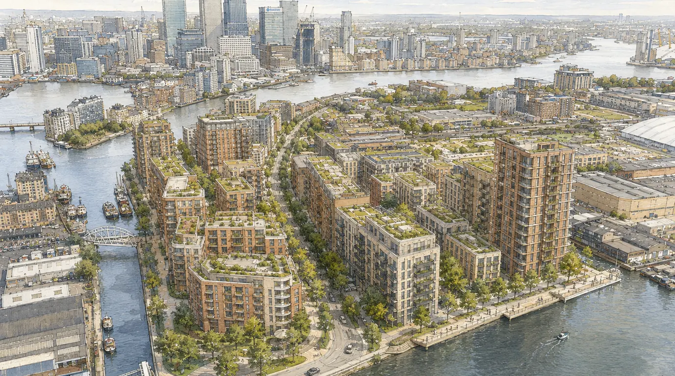
For this page, the aerial view is the central evidence asset. It shows why masterplan visualisation differs from a single exterior render: the value is not only facade realism, but the ability to explain spatial relationships between blocks, streets, edges and public spaces.
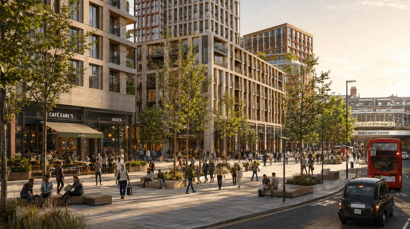
Public-realm views for street-level stakeholder understanding
The four public-realm views moved the story from district scale to human scale. These images explain how a person might experience arrival, movement, edge conditions, landscape and frontage activity. For a regeneration site, that ground-level reading can be as important as the aerial structure because it shows how the masterplan becomes usable space.
Street-level CGI also helps non-technical audiences understand what planning drawings often leave abstract: where people stand, how routes connect, how planting softens hard edges, and how activity at ground level changes the feel of the development.
How the CGI supported phasing and long-term vision
The CGI package supported phasing by giving the project team a consistent visual language across wide and close views. The aerial views explained the long-term structure. The public-realm views explained individual moments within that structure. Together they made the regeneration story easier to discuss without asking every stakeholder to interpret drawings in the same way.
That is the practical role of masterplan CGI: it does not replace design, planning or consultation work, but it gives those conversations a shared visual reference. When the same routes, public spaces and development edges appear across multiple images, the long-term vision becomes easier to test, question and refine.
Deliverables and review process for an area-based CGI set
The deliverables now sit as an area-based CGI set rather than one image type: aerial masterplan views, public-realm views, before-and-after restoration studies, adaptive reuse interiors, historical progress visuals and estate landscape concepts. Each format answers a different stakeholder question.
Review comments focus on legibility, not only image finish. The team checks whether routes are readable, whether public-realm and landscape improvements explain scale, whether restoration concepts keep the retained fabric understandable, and whether the visuals avoid overstating planning or delivery status.
Outcome: a clearer South Poplar visual story for review and communication
The finished page gives a clearer way to explain South Poplar as a group of related visual opportunities. Aerial images carry scale and district relationship. Street, interior and estate images carry restoration, reuse, landscape, arrival and human-scale quality.
The outcome should be understood as communication clarity, not a planning result claim. The visuals help a project team describe long-term potential, investor value and public-realm quality; they do not determine approval, public adoption or policy status.
Related regeneration and planning visualisation services
This project sits close to our residential development visualisation work, where apartment, BTR, co-living and mixed-use schemes often need aerial, public-realm and stakeholder views from one coordinated model. For submission-focused visual packages, our planning application visuals page explains the role of CGI, photomontage and verified views in London planning packs.
For moving presentations, 3D architectural animation can turn regeneration routes, phasing, reuse and arrival sequences into a controlled spatial narrative. The wider local planning context is covered on our Tower Hamlets borough page, and the projects index lists related CGI case studies.
Need regeneration, restoration or investor CGI for a London site?
Share the address, current photos and the story you need to prove. We can shape the right visual package for planning, investment or stakeholder conversations.