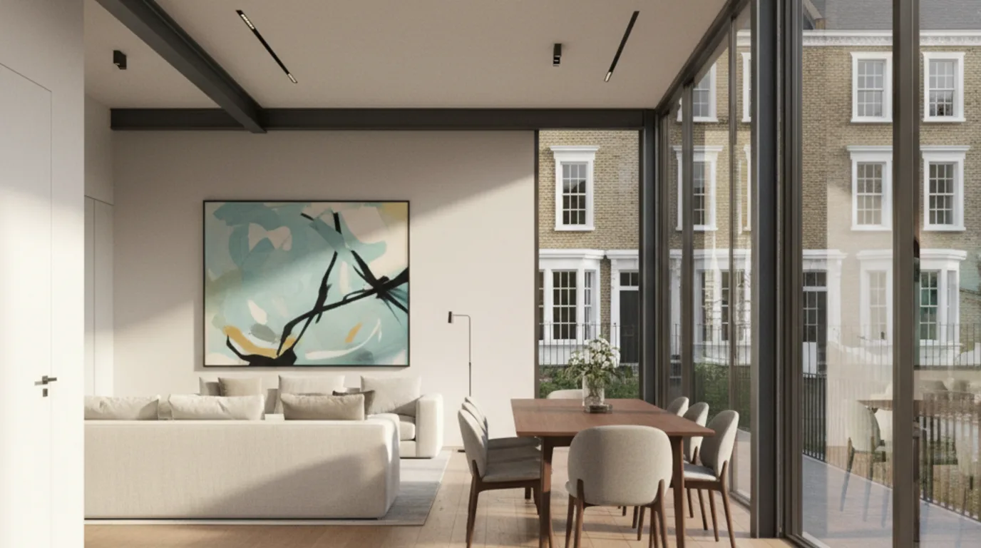
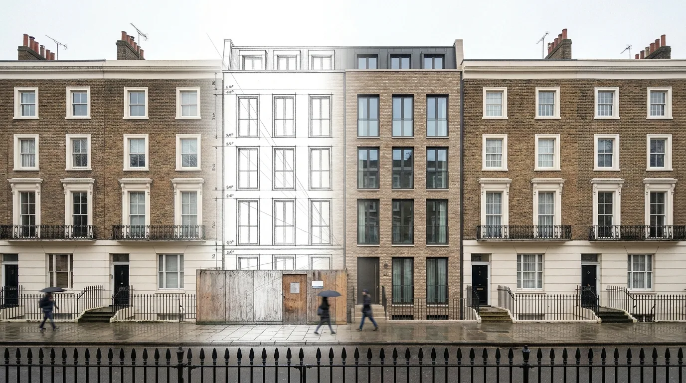
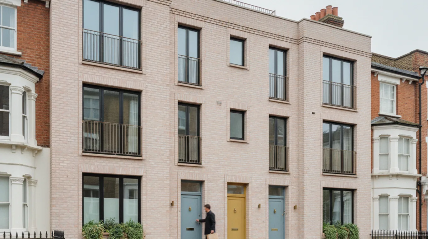
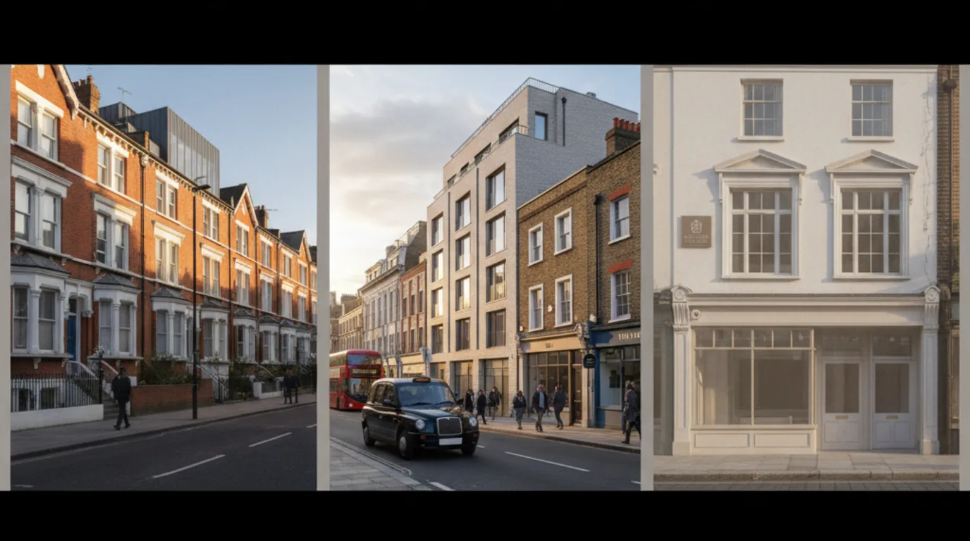
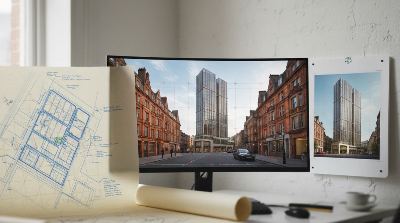
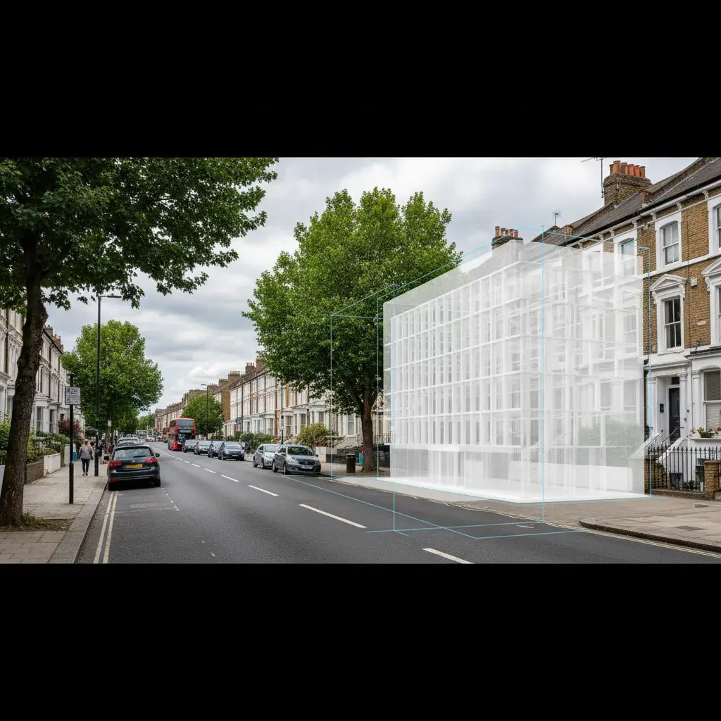
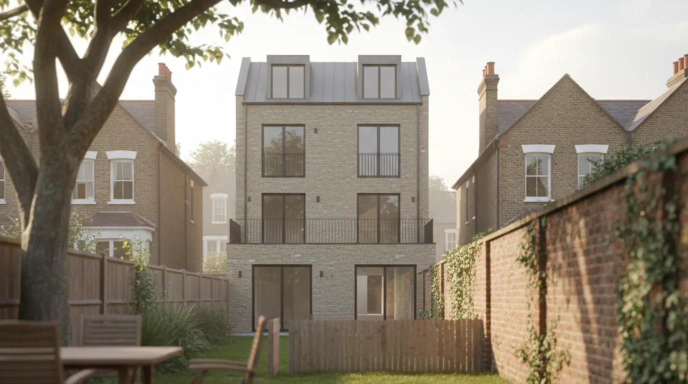
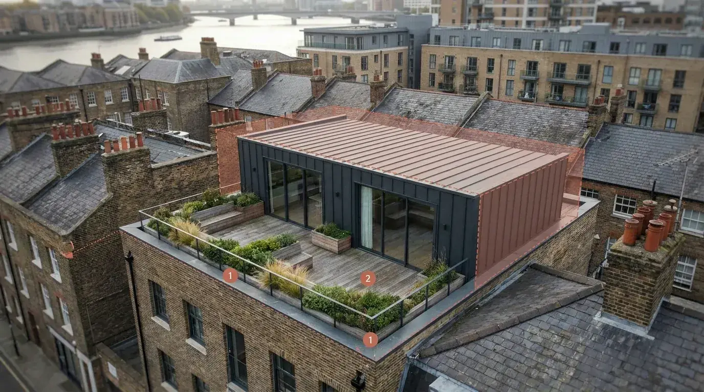
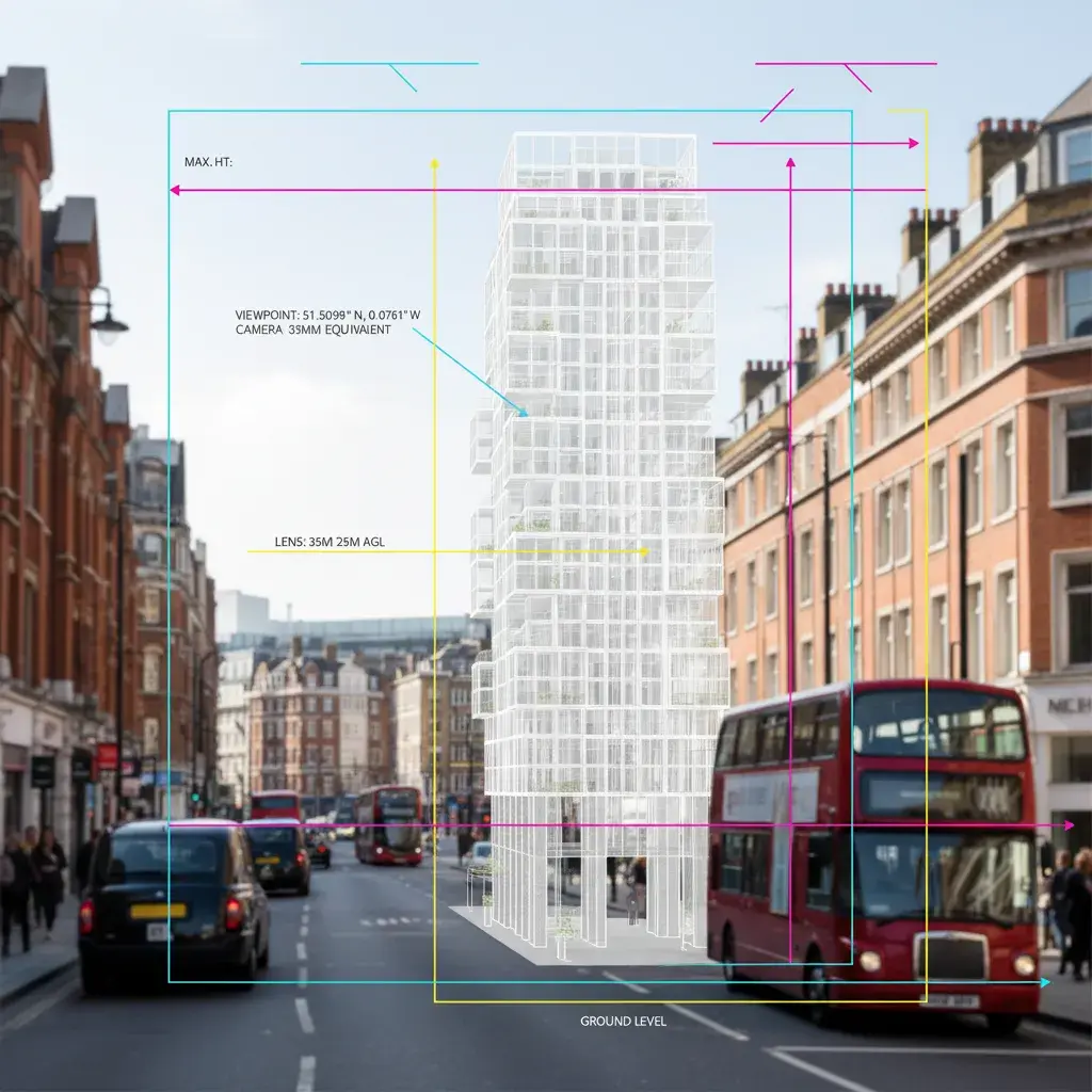
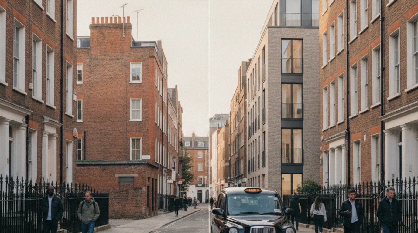
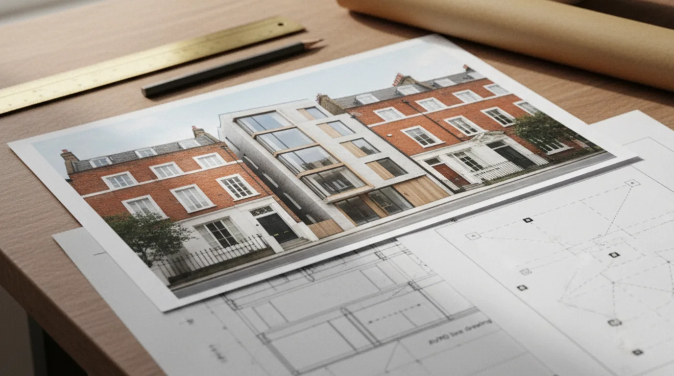
Annotated planning photomontage for a major Tower Hamlets application
London Borough Submissions · 2026

Planning application visuals for London borough submissions

We produce planning-grade CGI renders, photomontages, verified-view montages (VVM), and Accurate Visual Representations (AVR Levels 0 to 3 per the London View Management Framework) for London architects, developers, and planning consultants. Each visual is scoped against the relevant Local Planning Authority (LPA) validation list, application route and decision context, so the planning team can explain scale, massing, material and townscape effects clearly.

Request a quote
When This Is Needed

Planning visuals your London application has to include

Borough local validation lists and the London Plan together determine when CGI visualisations are expected, and the criteria differ by council. Tower Hamlets weighs high-poly context for major residential schemes; Camden prioritises roofline profiles in conservation areas; Southwark flags daylight overshadowing; Hackney, Islington and Lambeth focus on infill massing; and in West London, Hammersmith and Fulham and the high-density Wandsworth corridors expect highly detailed contextual montages.

Before-and-after planning photomontage showing an existing inner-London street view alongside the proposed CGI insertion at matched scale, perspective, and lighting
An illustrative planning visual comparing the existing context with the proposed scheme inserted at matched scale and lighting.
  • Conservation areas. Schemes inside or adjacent to a designated conservation area where character and appearance must be assessed.
  • Listed buildings & heritage assets. Listed building consent and works affecting the setting of a listed building, scheduled monument, or registered park.
  • Tall buildings (London Plan). Buildings meeting borough tall-building thresholds under the London Plan, where height, prominence, and skyline impact are material.
  • LVMF-protected views. Sites visible from London View Management Framework viewpoints: St Paul’s, Westminster, Tower of London, Greenwich Park, Parliament Hill, and Alexandra Palace.
  • Major developments. Borough validation lists across Tower Hamlets, Westminster, Camden, Hackney, and Southwark routinely require CGI visualisations for major schemes.
  • Townscape and visual impact. Where cumulative visual impact on a streetscape, square, or roofscape is a material consideration.

References: Tower Hamlets local validation list: CGI Visualisations, the London Plan tall-building policy, and the London View Management Framework supplementary planning guidance.

What We Deliver

Four CGI, photomontage, verified-view and AVR deliverables for a London planning submission

Each deliverable answers a different question a borough planning officer or committee will ask. The right mix depends on the site, the policy context, and what the case officer has requested at pre-application. Planning visuals sit within our wider range of London architectural visualisation services.

Committee pack with CGI photomontage, AVR wireframe sheet, and survey control-point notation laid out on an architect's desk
A committee pack laid out for submission: CGI photomontage, an AVR wireframe sheet, and survey control-point notation.

CGI / 3D Render

A CGI is an illustrative photorealistic image of the proposed building from agreed viewpoints. We use it to communicate design intent, materials, and massing inside Design and Access Statements, Heritage Statements, and Planning Committee packs.

Photoreal interior CGI render of a contemporary London infill living and dining space with floor-to-ceiling glazing onto a Georgian terrace street, used as a design and access statement reference
Inside a Design and Access Statement: interior CGI of the proposed living-dining space and finish direction for a London infill scheme.

Photomontage

We composite the proposed scheme into a real photograph of the site or street. Photomontage is non-verified by default: perspective and scale are matched by eye against your supplied site image.

Photomontage build for a London infill site between Georgian terraces: pencil construction lines and massing sketch on the existing gap site resolving into a finished photoreal CGI insertion of the proposed 4-storey building at matched scale and parapet alignment
Photomontage build for an infill site: pencil construction lines and massing block resolving into the finished CGI insertion at matched perspective and parapet.

Verified View (VVM)

A verified view aligns the montage to survey control points captured with a total station, plus camera GPS, bearing, focal length, and tripod height. The image carries an alignment summary so case officers, statutory consultees, committee members and inspectors can trace how the geometry was set. See our dedicated verified views.

AVR (Accurate Visual Representation)

AVR images follow the four London View Management Framework levels: AVR 0 wireline or outline, AVR 1 massing (location and visibility), AVR 2 architectural form including openings and shading, and AVR 3 materials, texture and reflections. The format is used for LVMF Strategic Views, Protected Views, and tall-building applications.

AVR3 elevation render of a contemporary five-house mews infill scheme in London stock brick with Crittall-style glazing, framed between two existing Edwardian end-of-terrace buildings
An AVR3-grade elevation render: the deliverable level a London View Management Framework view or a tall-building application typically requires at committee.
Application Types

Planning application types we prepare CGI for: outline, detailed, Section 73 and LDC

The visual package changes with the application route. A householder side return needs a single contextual view; an LVMF tall-building scheme needs verified AVR3 views from multiple protected viewpoints.

Triptych of three London planning contexts: a Victorian terrace householder extension, a full planning permission infill block, and a conservation-area Georgian shopfront restoration
Three planning contexts we prepare CGI for: a Victorian terrace householder extension, a full-permission infill block, and a conservation-area Georgian shopfront.

Householder applications

Extensions, loft conversions, and side returns. Visuals showing impact on neighbours and street character.

Full planning permission

New build and substantial alteration. Design, materials, and street context in one package.

Listed building consent

Sensitive visualisation of alterations to listed fabric and the setting around it.

Conservation area applications

Context-led views showing how the proposal reads inside the designated area.

Outline planning

Early-stage massing studies and parameter plans before detailed design.

Prior approval

Permitted development routes (Class MA, Class AA, upward extensions). Quick-turnaround compliance visuals.

Lawful development certificates

As-built and existing-use documentation where accurate representation is needed.

Planning appeals

Visuals prepared for inquiry, hearing, or written representations following refusal.

Our Process

From brief to committee-ready image: the planning visuals workflow

We work in a clear sequence with one structured refinement round. For the wider commission flow across other services, see how a CGI commission runs from brief to final delivery.

Architectural visualisation studio desk showing a verified-view photomontage on monitor with viewpoint trace plan and A3 committee print proof
Inside the workflow: a verified-view photomontage on screen beside its viewpoint trace plan and an A3 committee print proof.
  1. Brief & drawings. Review architect drawings, site photographs, planning notes, and the submission objective. Confirm viewpoints with the planning consultant.
  2. Camera & viewpoint plan. Viewpoint selection is agreed with the planning consultant, covering each camera position, lens, eye-line, and whether total-station survey data is needed for a verified view.
  3. Preview render. First-pass CGI or photomontage delivered for review, typically within five working days.
  4. Refinements. One structured round of changes covering materials, lighting, vegetation, and annotation.
  5. Final delivery. Final images in the formats required by the planning team: 4K JPG/PNG and optional A3/A1 PDF for committee packs.
Scope Boundary

What planning application visuals don't cover, and when to commission TVIA, daylight or 3D animation

We are the visualisation specialist on your project's planning team, not the planning consultant. Working within a defined scope keeps the visuals defensible and responsibilities clear. For schemes requiring high-precision visual evidence under TGN 06/19, we transition from illustrative CGIs to a survey-accurate verified views workflow. When evaluating regional skyline impacts or LVMF corridors, these views directly support a statutory townscape and visual impact assessment. For projects requiring photo-matched contexts without full georeferenced surveying, our tailored architectural photomontage for London planning is the ideal contextual format.

  • Planning agent or planning consultant services
  • Architectural drawings, technical drawings, or measured surveys
  • Submission of the application through the Planning Portal
  • Officer liaison or formal pre-application meetings
  • Daylight and sunlight technical reports (BRE 209) (referred out)
  • TVIA (Townscape and Visual Impact Assessment, referred to our dedicated service)
  • Rural Landscape and Visual Impact Assessment (LVIA), we cover urban TVIA only
Recent Case Studies

How we scoped planning visuals from pre-app to submission for residential infill schemes

Below are three recent scope examples where the visual package responded to a specific officer concern at pre-application, a conservation context, and a defined viewpoint requirement. Each project ran through the same five-step sequence and was scoped against a different deliverable mix.

Wandsworth photomontage with massing overlay showing a three-storey infill house between Edwardian semis in a Wandsworth conservation area

Wandsworth: inner south-west London conservation area infill house

Brief. A two-storey gap between a row of Edwardian semi-detached houses inside a Wandsworth conservation area. The developer was returning to planning after an earlier refusal and needed visuals that defended a revised three-storey infill against neighbour overshadowing objections.

Approach. We built four photomontages from agreed pavement viewpoints, an AVR 2 architectural-form study aligned to the neighbouring parapets, and an illustrative daylight overlay showing massing shadow against the closest first-floor window opposite. The architect supplied a clean RVT model, which shortened cleanup time, and we delivered the first-pass preview render inside the standard five-working-day window.

Deliverable mix.
  • 4× pavement photomontages (1376×768 AVIF + WebP)
  • 1× AVR 2 massing alignment sheet (A3 PDF)
  • 1× illustrative daylight overlay diagram (A3 PDF)

6 deliverables, packaged as a single design and access statement appendix.

Verified-view photomontage of a contemporary three-storey backland residential infill house seen from a Victorian terrace rear garden in a Lambeth conservation area

Lambeth: inner south London conservation area backland infill

Brief. A backland infill plot behind a Victorian terrace in Lambeth, with the proposed three-storey dwelling overlooking three separate rear gardens. The case officer asked for context-led CGIs and an illustrative overshadowing overlay showing massing shadow along a sensitive border with the adjacent conservation area to the north. Formal BRE 209 daylight and sunlight calculations were referred out to a specialist consultant.

Approach. We produced two contextual exterior CGIs from the public pavement, one verified-view photomontage from the affected rear garden, and an annotated overshadowing diagram for the officer's report. Drawings arrived as DWG, and neighbouring massing was modelled from OS MasterMap so the viewpoint geometry was traceable at officer review.

Deliverable mix.
  • 2× contextual exterior CGIs (1376×768 AVIF + WebP)
  • 1× verified-view photomontage with viewpoint trace plan (A3 PDF)
  • 1× annotated overshadowing overlay diagram, illustrative massing shadow (A3 PDF)

4 deliverables, packaged for the case officer's report.

Southwark AVR 3 verified view of a rooftop residential extension above a 1930s building inside a Southwark conservation area

Southwark: central south London conservation area rooftop extension

Brief. A two-storey rooftop residential extension above a 1930s commercial building in Southwark, sitting inside a conservation area and overlooked by listed Victorian warehouses on three sides. The architect needed an AVR 3 verified view from a nearby arterial road to address townscape impact at committee.

Approach. We coordinated a topographic survey of the existing rooftop with three control points, captured RAW photographs at the agreed AVR 3 capture specification, and produced a survey-matched photomontage with an alignment summary listing camera GPS, bearing, lens, and RMS pixel error. An illustrative daylight overlay against the nearest listed window completed the pack.

Deliverable mix.
  • 1× AVR 3 verified view (1376×768 AVIF + WebP, plus A3 print proof)
  • 1× alignment summary listing camera GPS, bearing, lens and RMS pixel error
  • 1× topographic control-point survey report (3 control points)
  • 1× illustrative daylight overlay against the nearest listed window (A3 PDF)

4 deliverables, packaged as a survey-controlled committee appendix.