Planning submissions
Southwark Council visuals for design statements, consultation packs, committee material and pre-application review.
Southwark Council submissions often need visuals that make scale, materials and street context easy to understand.
Southwark projects can move quickly between very different planning conditions: commercial retrofit around London Bridge and Bankside, tall-building and public-realm change around Elephant and Castle, waterfront masterplanning at Canada Water, corridor-scale growth on Old Kent Road, and conservation-area residential work in Peckham, Camberwell and Dulwich. The CGI package has to make the same proposal legible to clients, planning consultants, design officers, neighbours and commercial stakeholders.
Southwark visualisation work tends to land where a brief crosses several planning regimes at once: a retained warehouse frontage at Borough or Bermondsey, a tall-building proposal in the CAZ around London Bridge, a Canada Water masterplan plot, an Old Kent Road opportunity-area scheme, or a conservation-area extension in Dulwich, Camberwell or Peckham.
Southwark Council visuals for design statements, consultation packs, committee material and pre-application review.
Facade, lobby, workplace and hospitality CGI for London Bridge, Bankside, Borough and Bermondsey briefs.
Masterplan, public-realm and massing visuals for Canada Water, Old Kent Road and Elephant and Castle.
AVR, photomontage and camera-matched views where townscape, skyline or riverside visibility matters.
Material and extension studies for Peckham, Camberwell, Dulwich, Bermondsey and other sensitive streets.
Interior CGI for offices, hospitality, residential schemes, workspace, show apartments and client sign-off.
Southwark Council submissions are governed by the Southwark Plan 2022, the Old Kent Road Area Action Plan, the Canada Water Area Action Plan and the CIL Charging Schedule. Tall-building proposals route through Policy P16 and may engage the Mayor of London on stage-2 referral. A typical evidence pack includes a heritage statement, a daylight and sunlight assessment under BRE 209, pre-application advice notes, a townscape and visual impact assessment (TVIA) and verified views or AVR where the planning consultant identifies skyline, river or LVMF receptors.
Verified views are essential for Southwark sites where townscape, riverside, skyline or conservation-area character is central to the planning argument.
The need is normally set by the planning consultant, townscape consultant, project team or authority requirements. Larger mixed-use proposals, riverside development and conservation-area interventions should be reviewed early.
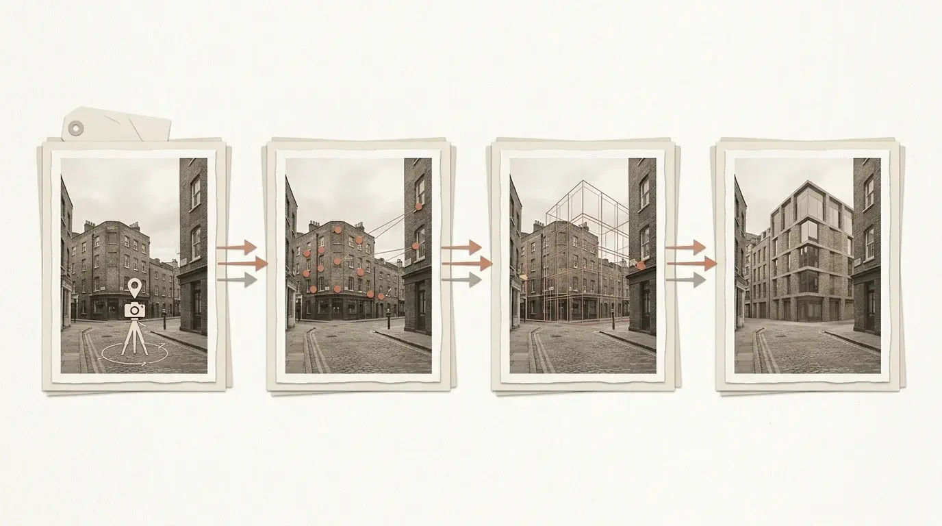
The first view acts as the surveyed AVR baseline: the existing Southwark street scene is held in the agreed camera position, with the proposed-development zone, viewpoint information and facade callouts marked for review. The second keeps the same view and annotation logic, then visualises a contemporary facade intervention within the conservation-area terrace so the planning team can compare existing context and proposed change directly.
For teams comparing routes, planning application visuals can cover design explanation and committee-pack imagery, while verified views are scoped when the viewpoint, survey relationship and methodology need to be documented.
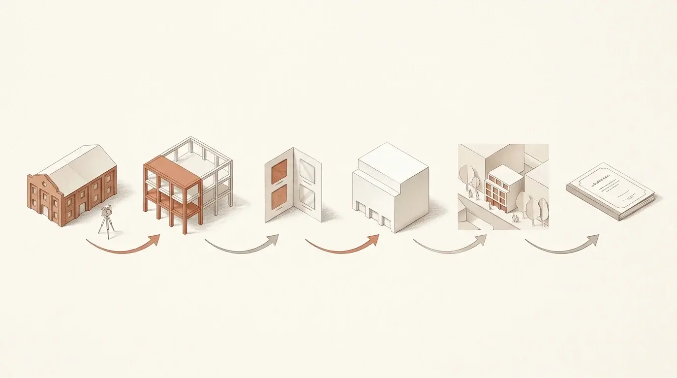
For Southwark projects that take the verified-view route, the methodology runs through four stages: viewpoint scoping, surveyed photography, camera matching against the 3D model, and final photomontage or AVR reporting.
Relevant references include Landscape Institute Technical Guidance Note 06/19: Visual Representation of Development Proposals, London View Management Framework where relevant, Southwark Council planning guidance. If the Southwark brief may need AVR, agree the visual route before photography and viewpoint selection are fixed.
Six Southwark project clusters sit inside one local authority: London Bridge, Borough and Bankside commercial retrofit; Canada Water masterplan and waterfront mixed-use; Elephant and Castle town-centre regeneration; Old Kent Road opportunity-area massing and public realm; Bermondsey warehouse and railway-arch frontage; and Peckham, Camberwell and Dulwich conservation-area residential alterations.
Show retained fabric, new facade language, lobby arrival, public-realm edge, roof visibility and commercial presentation quality inside a dense central London street context.
Communicate residential blocks, workspace, dock edges, landscape, public routes and phasing so a large mixed-use brief reads beyond a single building render.
Explain tall-building scale, active ground floors, station or campus context, public-realm changes and street-level experience for planning and consultation audiences.
Show mixed-use massing, active frontage, street widening, public-realm improvements, tower or mid-rise form and relationship to existing industrial and high-street plots.
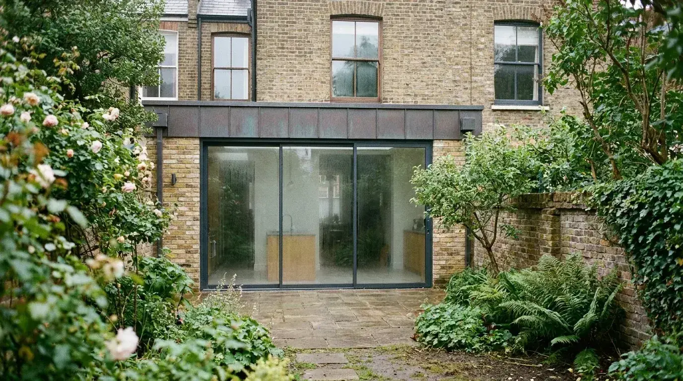
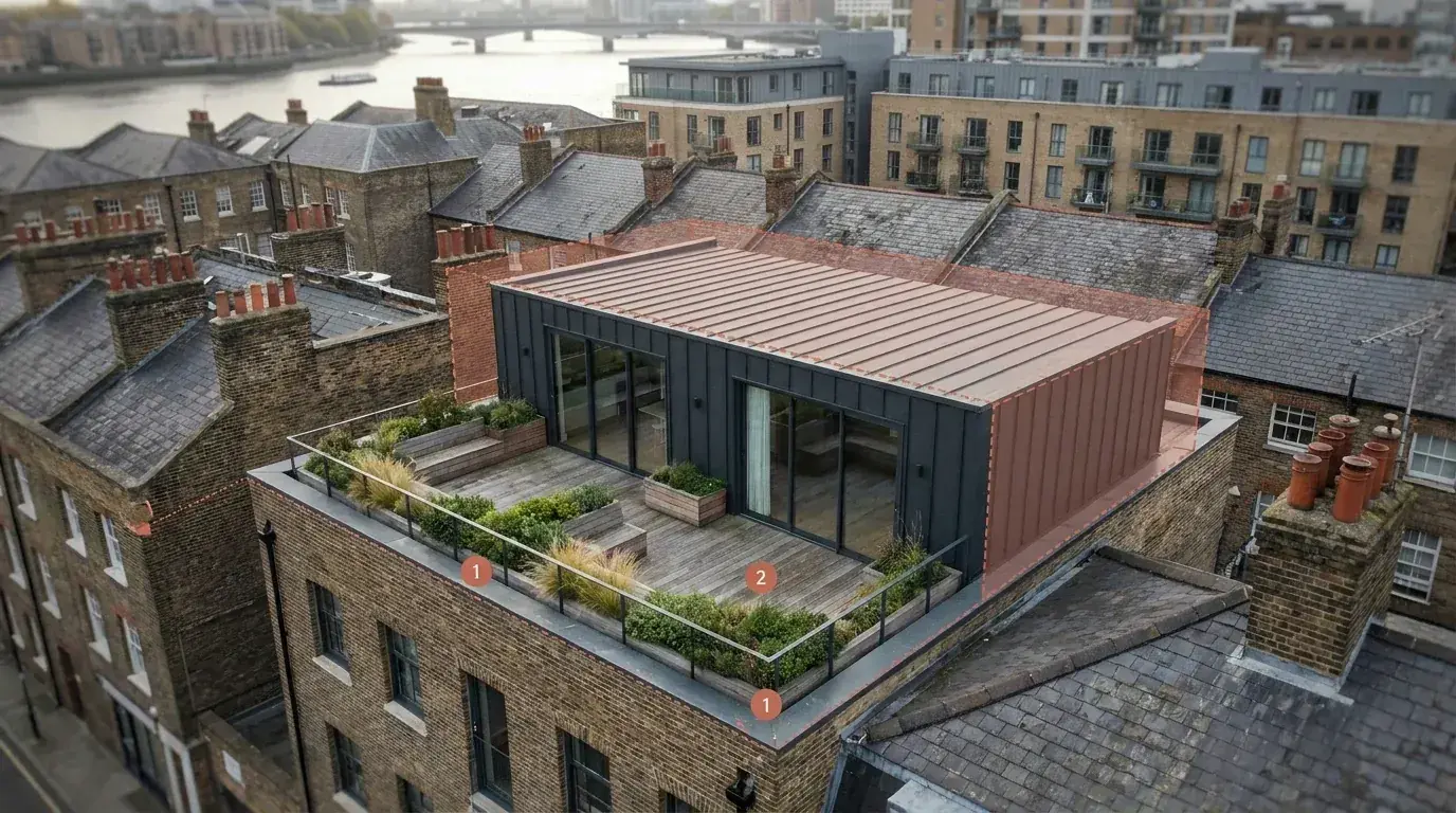
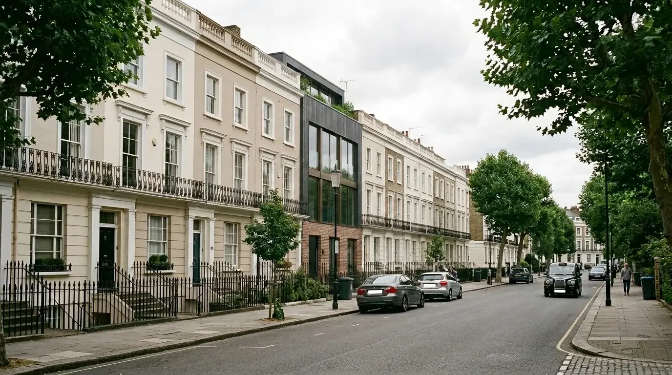
Clarify rear extensions, loft changes, garden rooms, infill, roof visibility, neighbour amenity, brick tone and conservation-area fit for private residential and planning review.
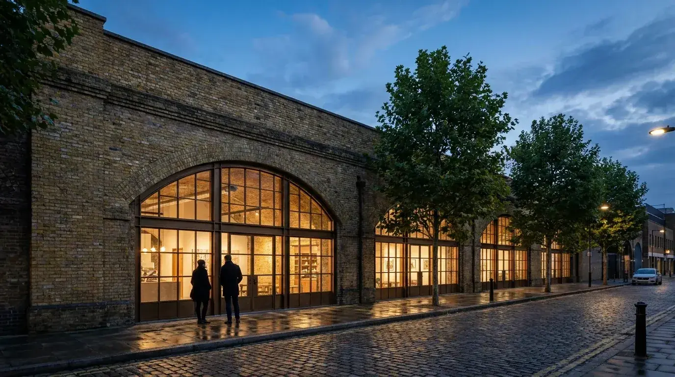
Communicate retained brick, new glazing, signage, lighting, food-and-beverage frontage, workspace entrances and public-realm behaviour in busy mixed-use streets.
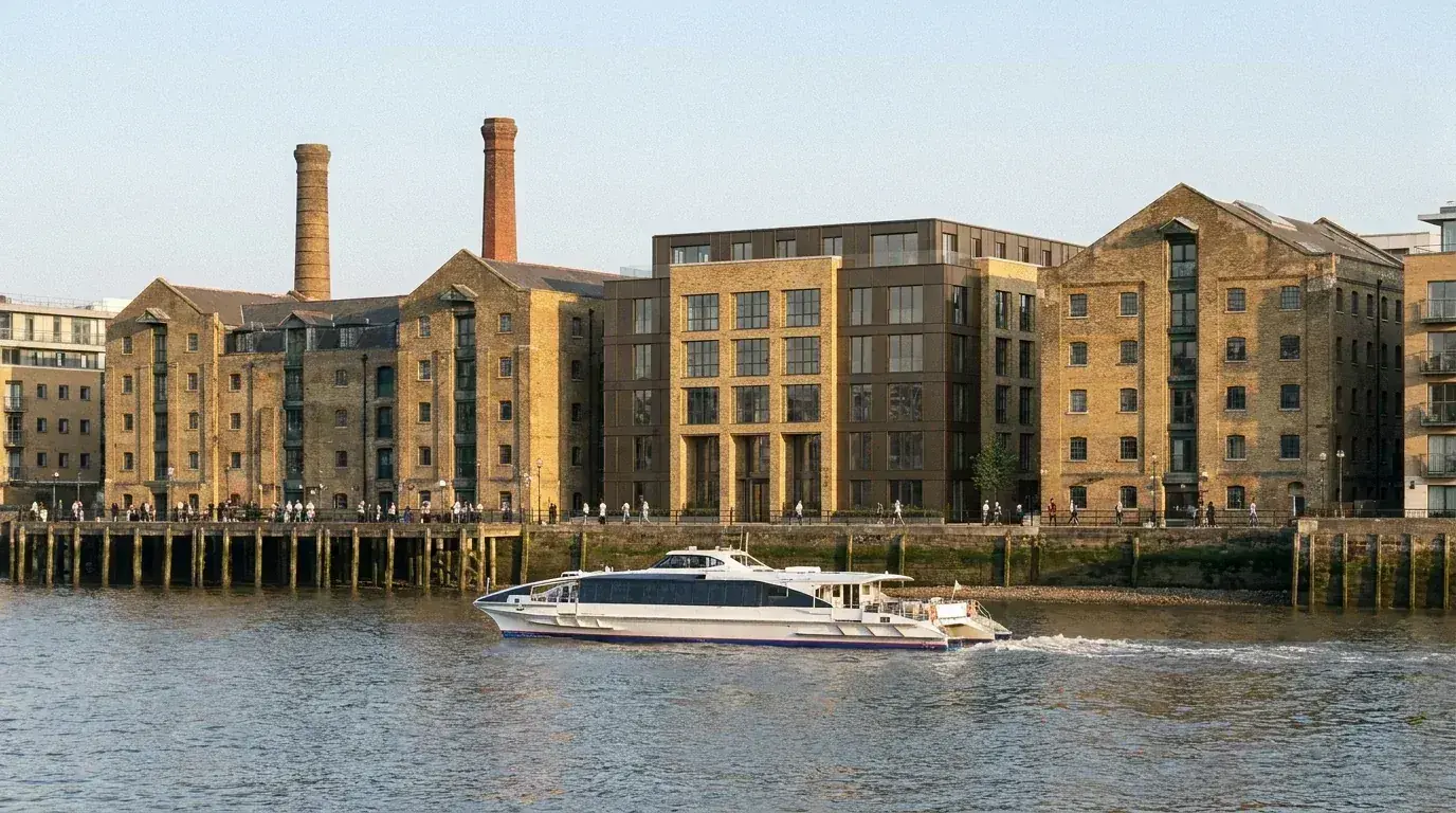
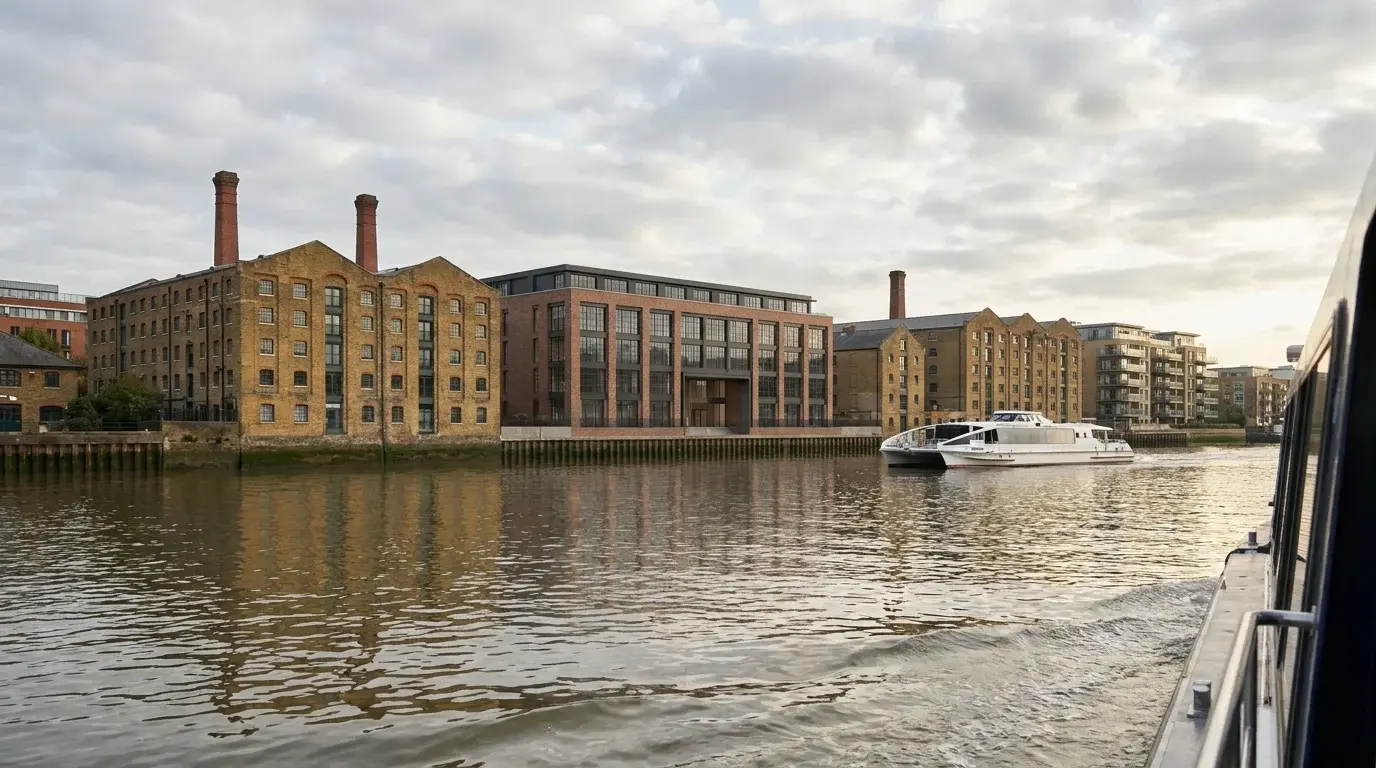
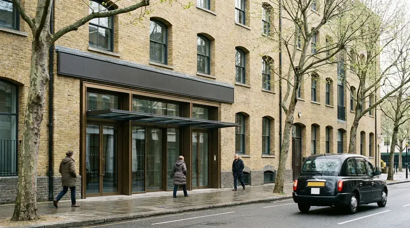
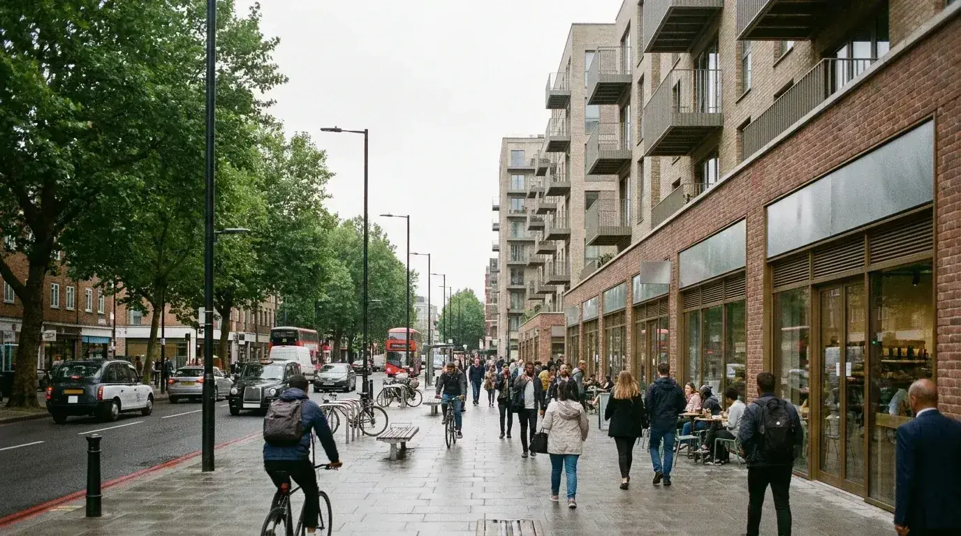
Commercial retrofit around London Bridge, Borough and Bankside lands inside the Central Activities Zone, sits across the Bankside, Borough High Street and Bermondsey Street conservation area appraisals, and routes through Policy P16 of the Southwark Plan 2022 wherever the proposal exceeds the local height threshold. A useful Southwark visual holds retained brick, new glazing, entrance hierarchy, signage, public-realm edge, servicing and roofline visibility in one readable street context.
Above this paragraph, the office retrofit workflow diagram traces the move from existing fabric and survey through retained-structure analysis to the final photomontage. The strongest image set separates planning evidence from commercial atmosphere. Planning views explain massing, materials, retained fabric and neighbour context. Presentation views can use the same model for lobby arrival, hospitality frontage, workspace character and leasing quality without pretending to be planning evidence. A pre-application advice meeting with Southwark Council, a heritage statement, a daylight and sunlight assessment under BRE 209, design review panel feedback, a TVIA and a CIL liability notice are usually arranged in parallel.
A Southwark commercial retrofit visualisation package can include street-scene photomontages, facade material studies, retained-fabric diagrams, lobby renders, public-realm edge views, planning-report figures, committee visuals and leasing variants. Each output should answer one decision rather than acting as a generic render count.
For London Bridge, Borough and Bankside, the same model may need a restrained planning view and a more polished commercial presentation view. Keeping those outputs separate helps the planning consultant use the image as evidence while the developer or leasing team still gets credible commercial material.
Facade visuals need enough detail for brick tone, glazing depth, metalwork, signage, lighting and entrance hierarchy to be judged against the existing street. Southwark commercial streets often mix warehouse fabric, railway infrastructure, market frontage, office blocks and visitor activity, so the image should not isolate the proposal from the street that gives it planning meaning.
Public-realm detail matters because many Southwark retrofit sites are judged at pavement level. A useful image can show cafe spill-out, cycle movement, servicing doors, planting, lighting, thresholds and pedestrian routes without letting these elements obscure the building argument.
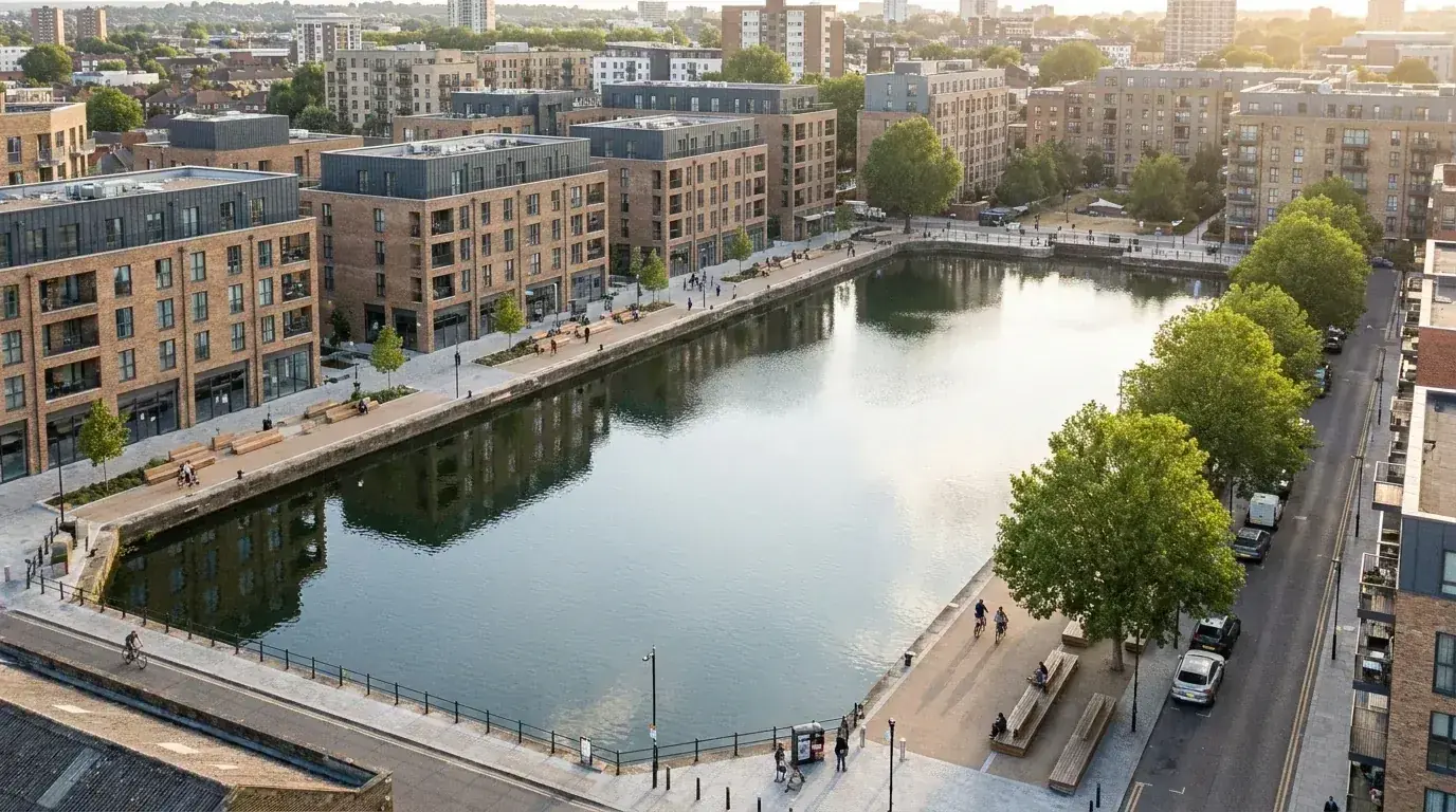
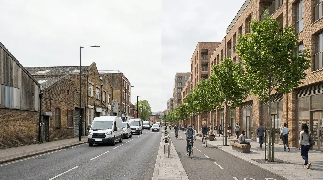
Canada Water and Old Kent Road sit inside Southwark's two largest opportunity-area frameworks. The Canada Water Masterplan was consented in 2020 (British Land and AustralianSuper) and is being amended through a Section 73 application in 2026, while the Old Kent Road Area Action Plan ties development to the Bakerloo Line Extension growth corridor. A regeneration CGI explains how building mass, dock edge, public realm, routes, landscape and transport assumptions read across a wider planning argument.
Above this paragraph, the Old Kent Road process composite holds the existing high-street and industrial fabric beside the proposed mid-rise massing so frontage, pavement widening and public realm can be assessed in one frame. Early masterplan visuals tend to be more useful when they hold massing, phasing and public-realm intent before photoreal finish. Later views add material, planting, lighting and active-frontage detail once the planning argument lands. A heritage statement, a TVIA, design review panel feedback and a daylight and sunlight assessment under BRE 209 typically run in parallel with the visual programme.
Canada Water visualisation should usually show the water, public routes, mixed-use blocks and landscape together. Old Kent Road visuals often need to explain how larger housing, commercial frontage and movement changes sit beside existing industrial or high-street plots. Elephant and Castle visuals tend to need more town-centre, station, campus and public-realm context.
The common thread is context. The image should show why the proposal belongs in that Southwark location, what changes at ground level, and how the development scale relates to streets, routes, neighbours and public space.
Verified views may become relevant where a Southwark regeneration project affects skyline, river views, tall-building receptors, conservation-area settings or sensitive public viewpoints. The decision should be made before photography and modelling begin, because camera position, survey control and reporting requirements can affect the programme.
A useful early step is to separate illustrative CGI from AVR or photomontage evidence. Illustrative CGI can test design intent and stakeholder communication. AVR and verified views document the relationship between the real viewpoint, survey data, camera match and proposed model.
Service scope on a Southwark brief follows the planning route: design review panel and pre-application advice for tall-building or masterplan schemes, conservation-area material studies for Bankside or Bermondsey heritage settings, verified-view methodology for LVMF or river-edge receptors, and rear-extension sign-off CGI for Dulwich Village or Camberwell Grove conservation areas.
Southwark Council planning images for design-and-access support, public consultation, committee packs, material studies, opportunity-area context and neighbour-facing explanation.
Discuss this service Verified ViewsAVR, verified-view and photomontage support for tall-building, riverside, CAZ-adjacent, conservation-area and townscape-sensitive Southwark sites.
Discuss this service Commercial DevelopmentsCommercial retrofit, workspace, hospitality, retail, hotel and mixed-use CGI for London Bridge, Borough, Bankside, Bermondsey and Elephant and Castle.
Discuss this service Exterior RenderingsFacade, street-scene, public-realm, roofline and masterplan views for Southwark streets, estates, waterfront plots and growth-area sites.
Discuss this service Interior VisualisationsInterior CGI for commercial lobbies, workspace, hospitality, show apartments, residential refurbishments and design sign-off across Southwark.
Discuss this service House ExtensionsRear extensions, roof alterations, garden rooms, basements, infill and townhouse or terrace visuals for Peckham, Camberwell, Dulwich, Bermondsey and Rotherhithe homes.
Discuss this serviceNeed Southwark planning visuals, conservation context, verified-view support and material studies that explain the design argument without overstating the proposal.
Need masterplan, public-realm, massing, consultation and commercial CGI for Canada Water, Old Kent Road, Elephant and Castle and central Southwark growth sites.
Need workspace, hospitality, retail, lobby, show-apartment and fit-out visuals that balance presentation quality with believable Southwark context.
A Dulwich, Peckham or Camberwell rear extension, a Bermondsey loft, a Borough basement or a Rotherhithe garden room each lands at different points in the planning route. CGI is the bridge from drawings to a sign-off the homeowner, architect and planning officer can argue from.
Southwark CGI is judged on whether reviewers can read scale, street fit, material tone and the difference between retained fabric and proposed intervention from one credible image. Public-realm effect, roof visibility and neighbour amenity carry the rest. For facade, roofline and streetscape visibility, see exterior rendering support.
A Southwark visualisation programme opens with the planning route (full application, Section 73 amendment, listed-building consent or Mayor of London stage-2 referral), then matches model detail and viewpoint method to the receptors that decision will be assessed against. A masterplan image at Canada Water needs different evidence from a Bermondsey shopfront frontage or a Dulwich rear extension.
Review the Southwark address, drawings, planning context, site photos, references, deadline and intended image use.
Agree the visual purpose: Southwark Council planning explanation, verified-view support, extension design review, consultation, investor presentation or marketing.
Model the existing and proposed condition with enough neighbouring context for the Southwark setting to read clearly.
Compose street, waterfront, public-realm, interior, roofline, photomontage or verified-view viewpoints before final rendering.
Apply materials, lighting, furniture direction, facade detail and borough-specific context, then deliver print-ready and web-optimised stills or iterations.
Tell us where the Southwark project is, what stage it has reached, which drawings or references are ready, and whether the images need to support planning, design sign-off, investor review, consultation or marketing.
You can also email drawings, image references and deadlines to hello@architecturalvisualisationlondon.uk.
A Southwark visualisation quote depends on the site address, planning stage, visual method and decision the imagery needs to support.
Send drawings and context for a brief review and we will confirm the right visual route before quoting.
Nearby borough links extend Southwark project context across central London, the river edge and adjacent growth areas.
Westminster and the City of London sit directly across the Thames from Southwark, so river views, skyline context, commercial retrofit and verified-view briefs often need to consider both sides of the river.
Lambeth shares South Bank, Waterloo and Vauxhall planning logic with Southwark, especially for public-realm, cultural, riverside and townscape-sensitive visualisation.
Tower Hamlets carries a related verified-view and tall-building demand pattern across Canary Wharf, Isle of Dogs, Whitechapel and Aldgate. See Tower Hamlets verified views and Canary Wharf CGI for the matching east London growth context.
Camden links Southwark back into the central borough cluster through mixed-use, conservation-area and commercial retrofit visualisation rather than pure residential CGI.
Not every Southwark planning application needs CGI, but visual material is often useful when the proposal affects street context, public realm, roofline, conservation-area character, neighbour relationship, commercial frontage or a larger regeneration setting.
Verified views are typically required where the project affects a sensitive townscape, skyline, river view, tall-building receptor, conservation-area setting, CAZ edge or LVMF vista (notably 11A and 11B from Greenwich Park and Blackheath Point). The viewpoint, surveyed photography and methodology are agreed with the planning or townscape consultant before photography and modelling begin.
Useful visuals include street-scene CGI, rear-extension views, roofline studies, material comparisons, existing-and-proposed photomontages and annotated views that separate retained fabric, proposed work and neighbouring context.
Yes. CGI can support masterplan context, public-realm explanation, massing review, consultation packs, marketing images and planning visuals for Canada Water, Elephant and Castle and other Southwark regeneration briefs.
Typical inputs include the site address, existing and proposed drawings, site photos, preferred viewpoints, planning notes, material references, image use, review-round expectations and deadline.