Planning submissions
Lambeth Council visuals for design statements, consultation packs, committee material and pre-application review.
Lambeth Council submissions often need visuals that make scale, materials and street context easy to understand.
Lambeth projects cover a broad spectrum of London planning contexts: the nationally significant cultural and visitor hub of the South Bank and Waterloo, the tall-building and high-density growth of Vauxhall and the Albert Embankment, the vibrant town-centre and commercial activity of Brixton, and the heritage-sensitive residential streets of Kennington, Clapham, Stockwell and Streatham. A Lambeth CGI package must balance these different scales and audiences in a single credible image set.
CGI is essential in Lambeth when the planning or design decision involves scale, townscape effect, river-frontage visibility, public-realm benefit or the sympathetic treatment of conservation-area fabric.
Lambeth Council visuals for design statements, consultation packs, committee material and pre-application review.
AVR, photomontage and camera-matched views where townscape, skyline or riverside visibility matters in Lambeth.
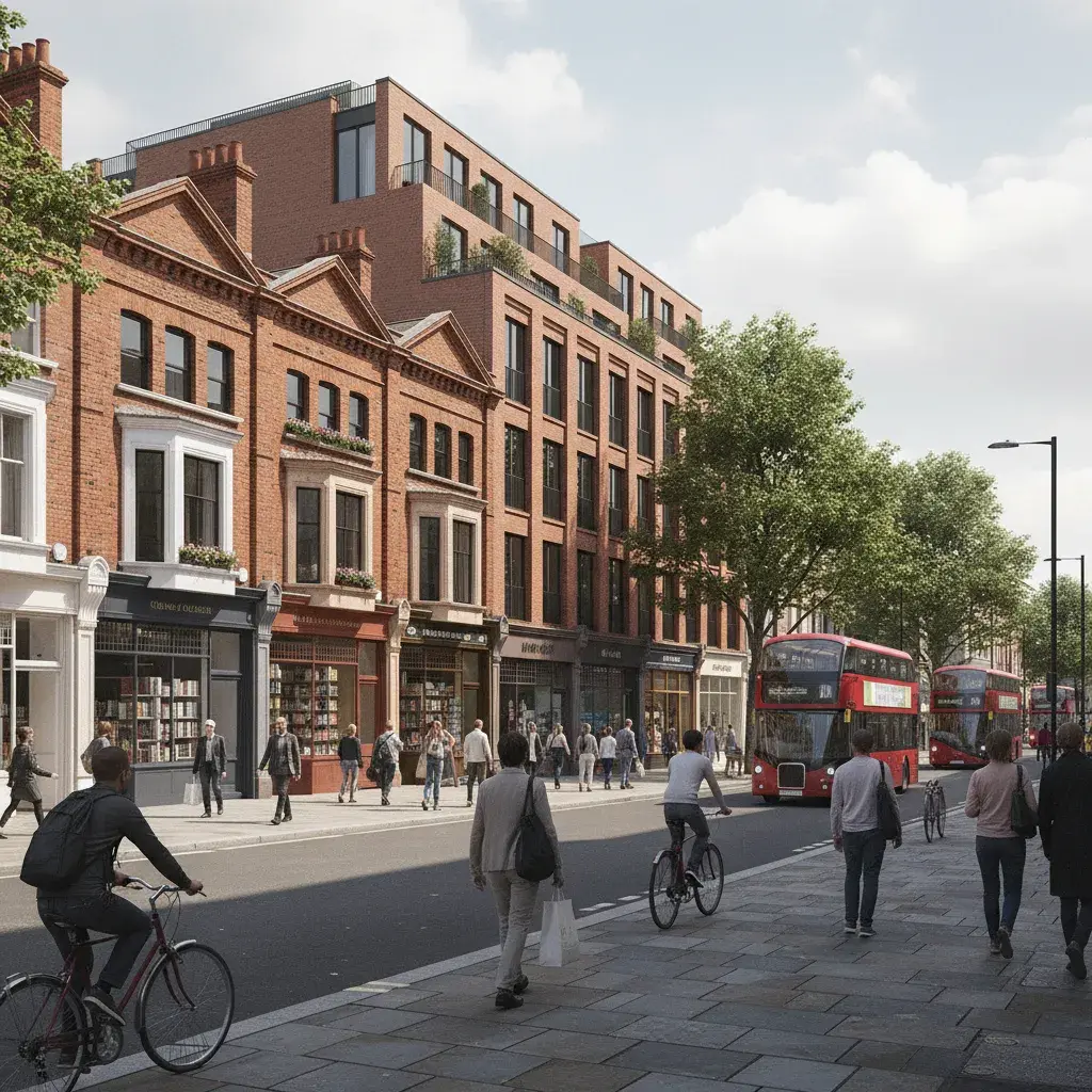
Facade, lobby and workspace CGI for South Bank, Waterloo and Brixton cultural and commercial projects.
Masterplan, public-realm and massing visuals for Waterloo, Vauxhall and Brixton regeneration areas.
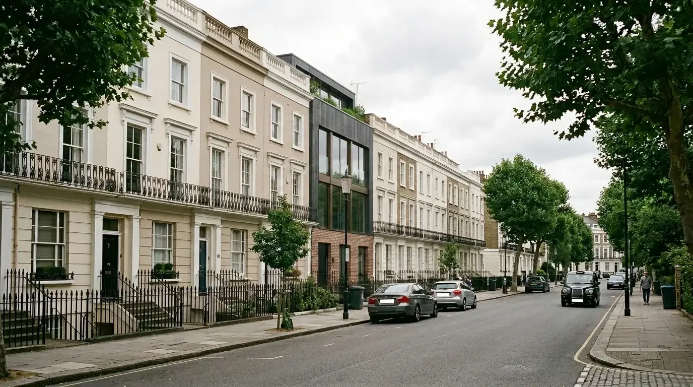
Material and extension studies for Kennington, Clapham, Stockwell, Brixton and other sensitive Lambeth streets.
Interior CGI for offices, hospitality, cultural spaces, show apartments and design sign-off across Lambeth.
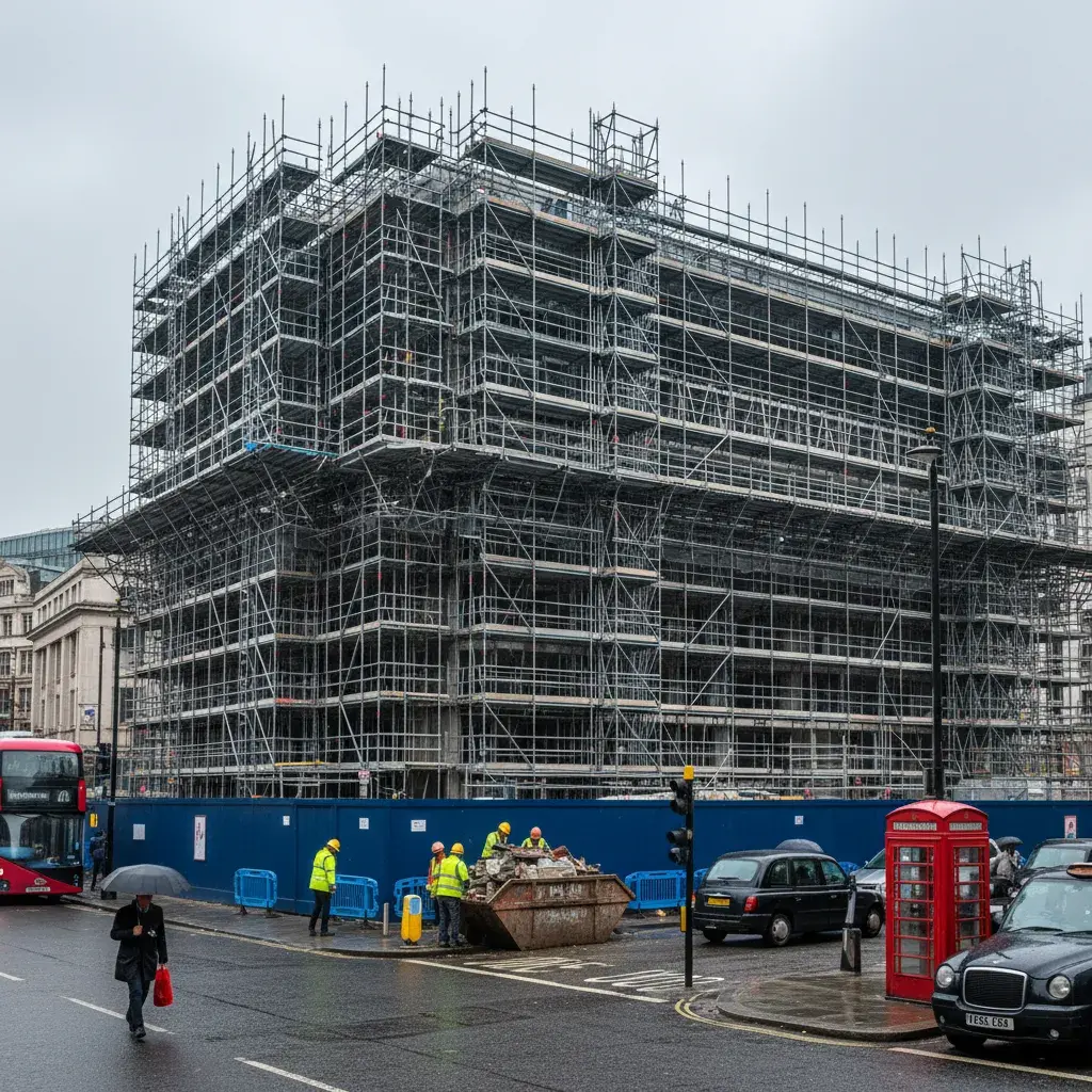
Lambeth Council submissions are guided by the Lambeth Local Plan 2021 and neighbourhood plans for South Bank & Waterloo. Major schemes in the Vauxhall, Nine Elms and Battersea (VNEB) Opportunity Area or the Waterloo Opportunity Area may require tall-building studies, verified views (AVR) and townscape impact assessment. Lambeth has 62 conservation areas covering 30% of the borough, making heritage-sensitive visuals a common requirement.
Verified views are essential for Lambeth sites where townscape, riverside, skyline or conservation-area character is central to the planning argument.

The need is normally set by the planning consultant, townscape consultant, project team or authority requirements. Tall-building proposals in Waterloo or Vauxhall and prominent riverside sites should be reviewed early.
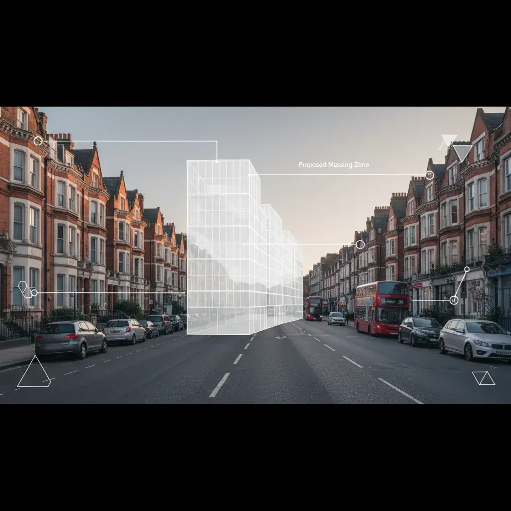
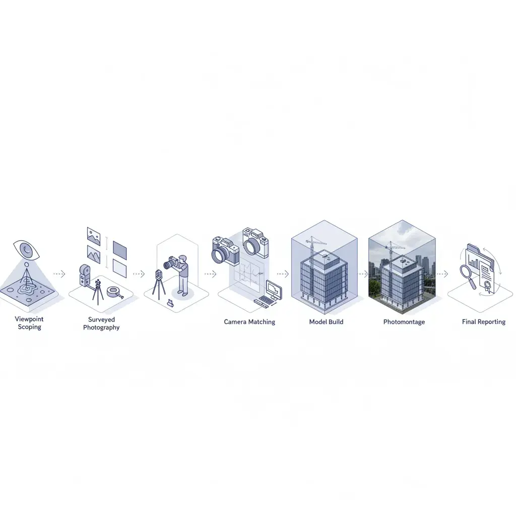
The first view acts as the surveyed AVR baseline: the existing Lambeth street scene is held in the agreed camera position, with the proposed-development zone, viewpoint information and facade callouts marked for review. The second keeps the same view and annotation logic, then visualises a contemporary facade intervention within the conservation-area terrace so the planning team can compare existing context and proposed change directly.
For teams comparing routes, planning application visuals can cover design explanation and committee-pack imagery, while verified views are scoped when the viewpoint, survey relationship and methodology need to be documented.
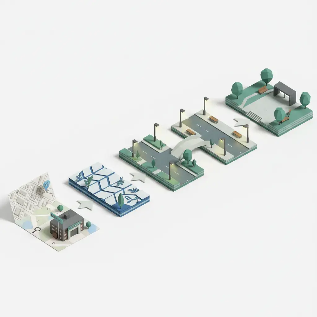
For Lambeth projects that take the verified-view route, the methodology runs through four stages: viewpoint scoping, surveyed photography, camera matching against the 3D model, and final photomontage or AVR reporting.
Relevant references include Landscape Institute Technical Guidance Note 06/19: Visual Representation of Development Proposals, Lambeth Council planning guidance. If the Lambeth brief may need AVR, agree the visual route before photography and viewpoint selection are fixed.
Six Lambeth project clusters define the borough's visualisation demand: Waterloo and South Bank cultural and commercial hubs; Vauxhall tall-building and riverside growth; Brixton town-centre and mixed-use frontage; Albert Embankment riverside regeneration; Kennington, Clapham and Stockwell residential extensions; and borough-wide public-realm and station-edge improvements.
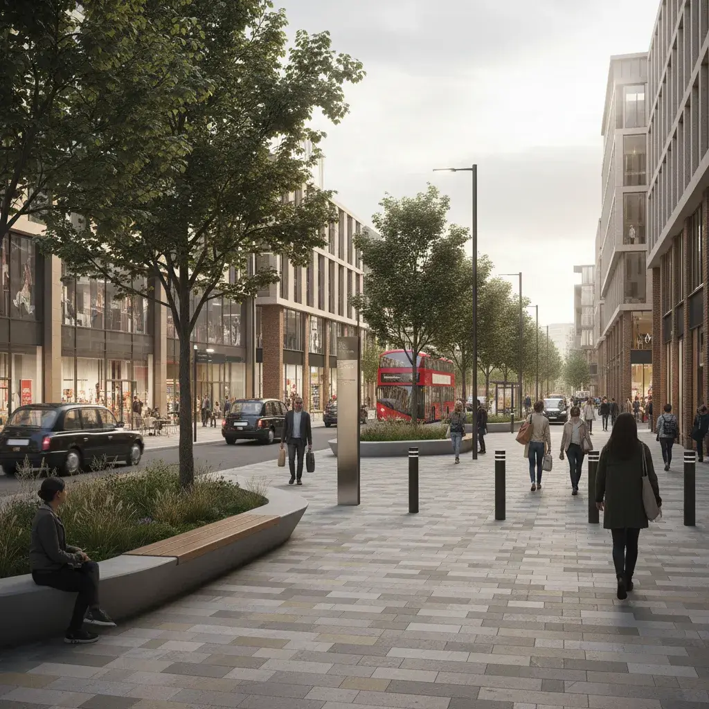
Communicate station-edge improvements, cultural venue frontages, high-quality paving and active ground-floor life in one of London's busiest visitor hubs.
Evidence tall-building massing, skyline effect and riverside townscape impact using surveyed cameras and verified-view methodology.
Show modern architectural interventions against iconic concrete or glass contexts, highlighting material tone and public-realm connection.
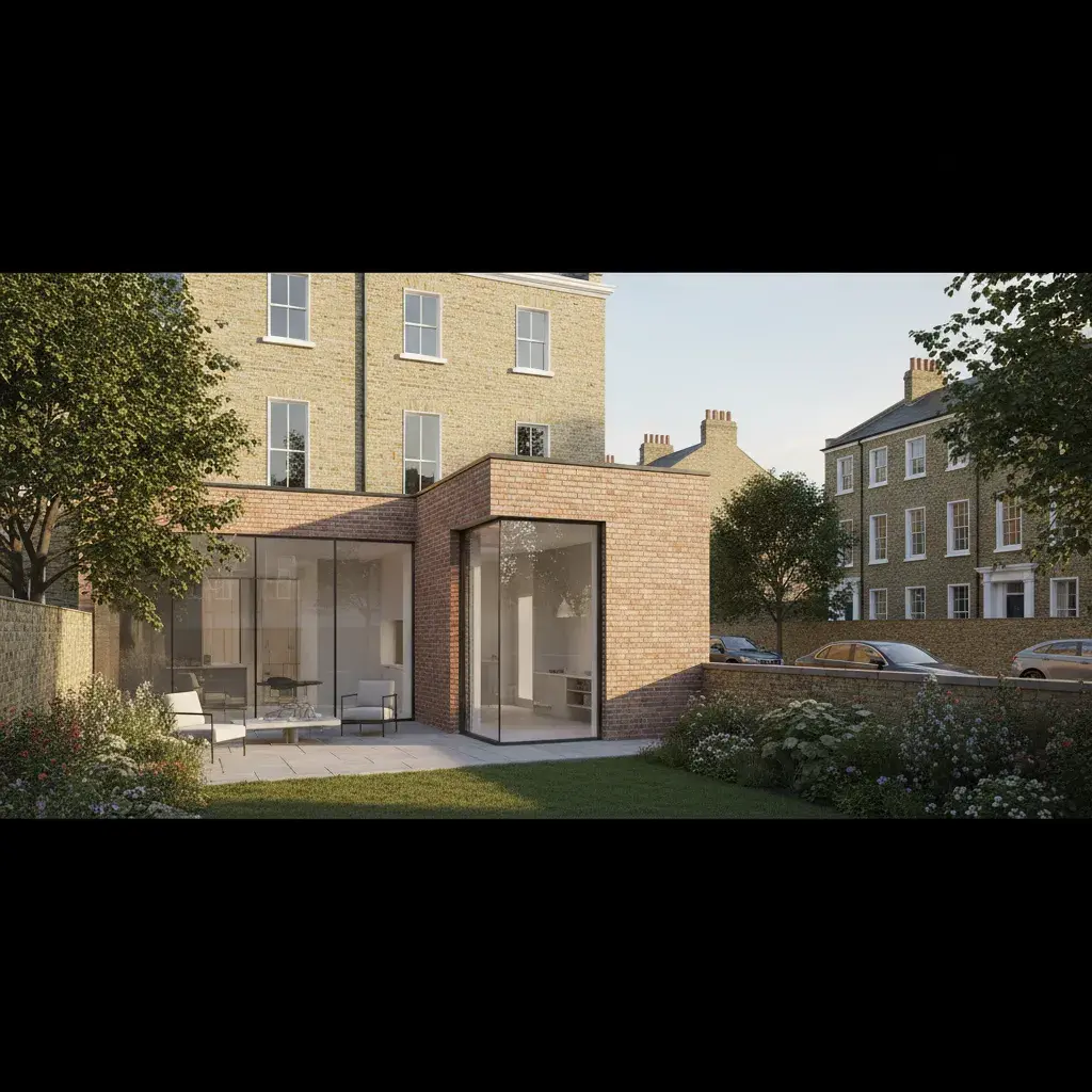
Clarify rear extensions, roof changes and material junctions for Georgian and Victorian terrace homes in sensitive heritage contexts.
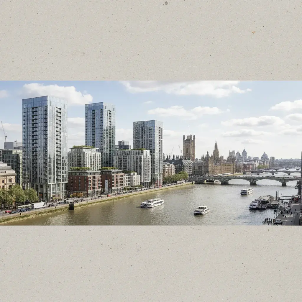
Show high-density residential and commercial massing with views towards Westminster and the Houses of Parliament.
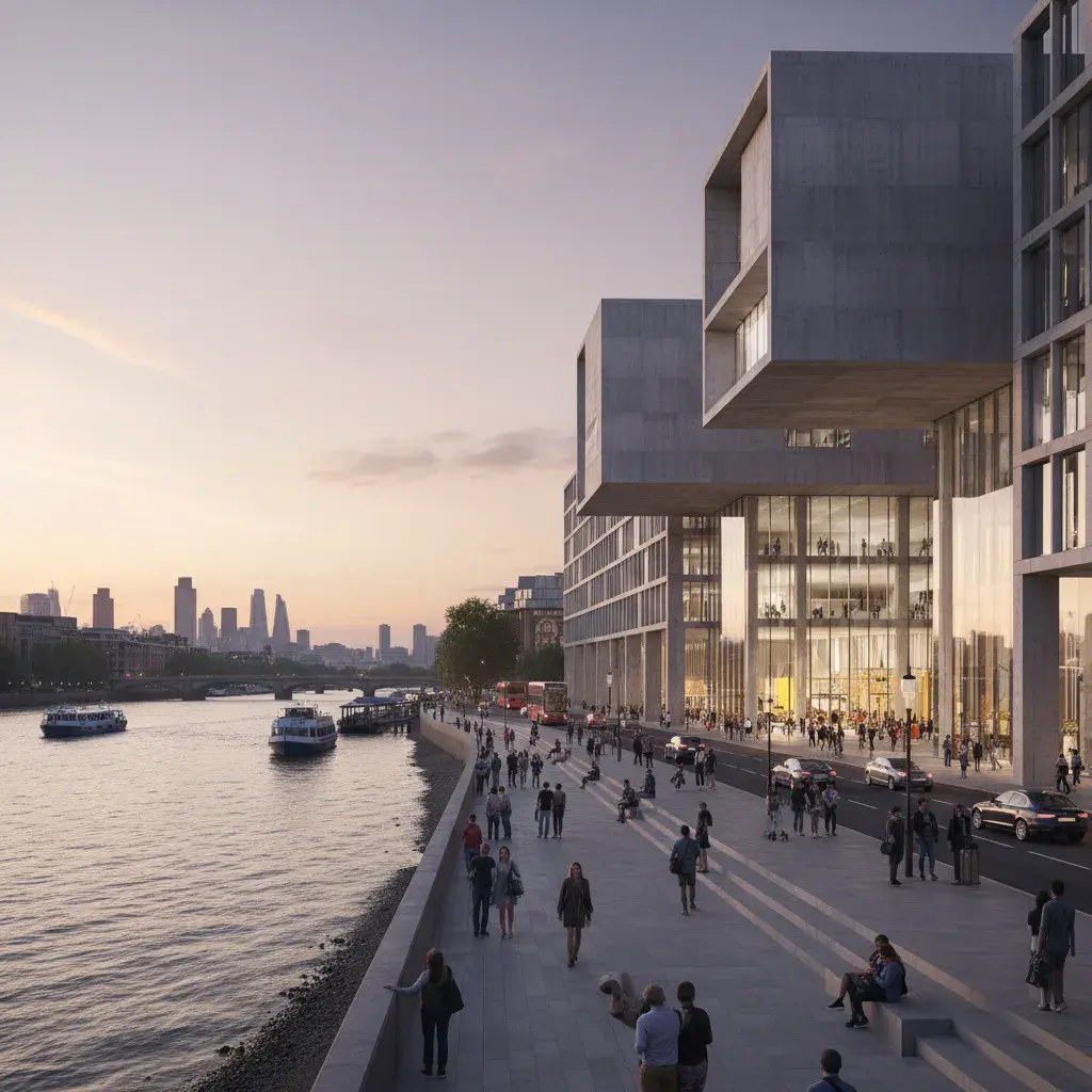
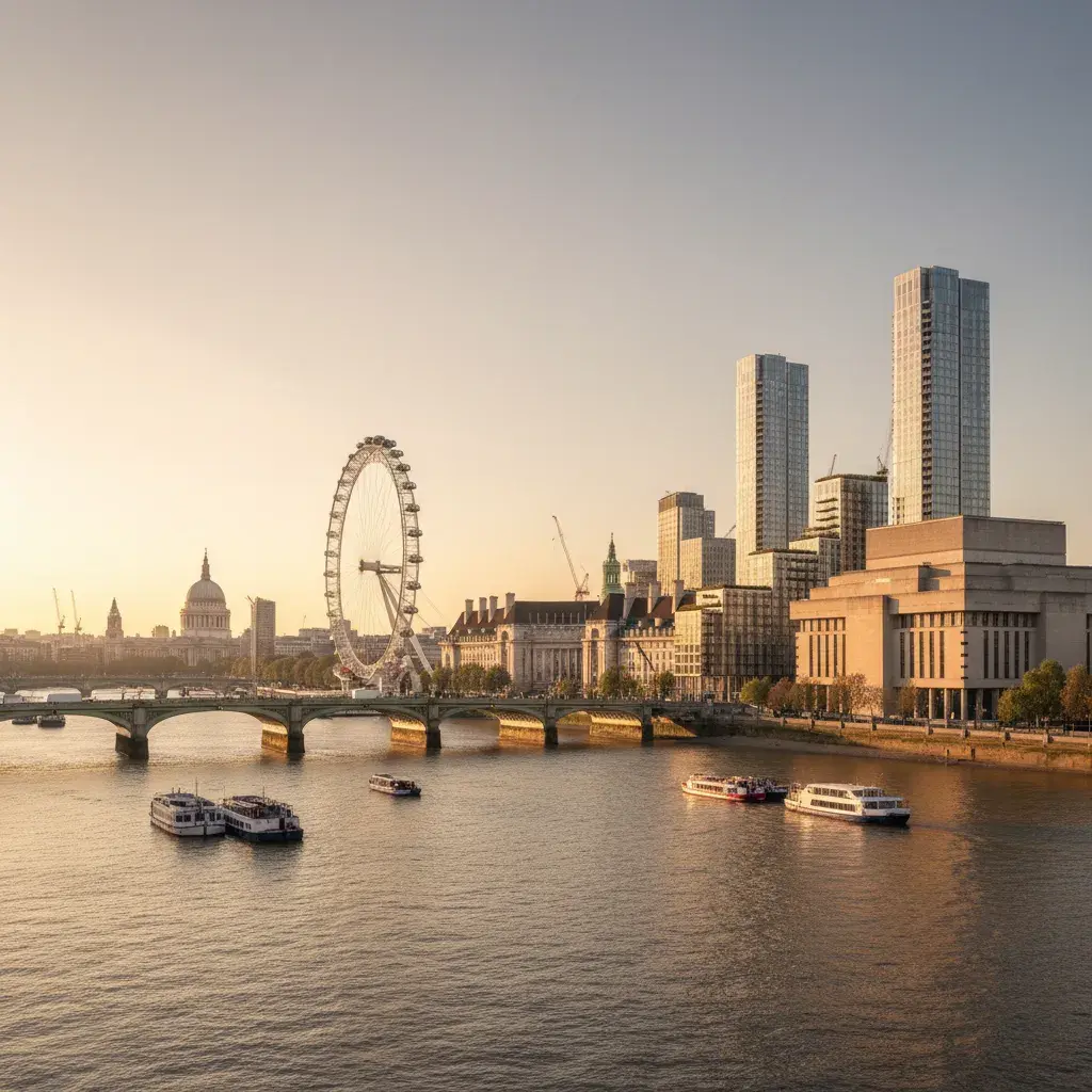
Waterloo and the South Bank represent one of the most high-profile visualisation briefs in Lambeth. Projects here often sit within the Waterloo Opportunity Area, which targets 1,500 new homes and 6,000 new jobs by 2041, and must address the specific visitor, cultural and transport context of the South Bank and Waterloo Station. The visual task is to communicate high-quality public realm, active frontage, and modern architectural interventions that respect the area's iconic brutalist and riverside character.
The workflow diagram traces the process from station-context analysis and public-realm survey through paving and landscape design to final photorealistic CGI. The strongest images in this cluster separate the technical planning evidence from the commercial and stakeholder presentation material. Planning views emphasize streetscape fit and pedestrian routes, while presentation views can focus on the evening atmosphere, lighting spill and the vibrancy of the cultural offer. Lambeth's South Bank and Waterloo neighbourhood plans provide the policy backdrop for these visual submissions.
An architects desk flat-lay captures the specific inputs for a Waterloo brief: an Ordnance Survey map of the South Bank and Waterloo Station with the site circled, A3 drawings of a new cultural venue entrance, and material samples of concrete and bronze. This "deskscape" evidences the rigorous design thinking that precedes the 3D model, ensuring the final visual is anchored in the reality of the Lambeth streetscape and the requirements of the planning authority.

A cultural-workspace interior view near Waterloo captures the scale and materiality a future tenant will experience. By showing exposed concrete, high ceilings and framed views of the London Eye or the South Bank, the CGI builds confidence in the spatial quality and character of the proposal before construction begins. For larger schemes in this area, we scope and deliver verified views (AVR) to document the project's impact on key townscape receptors.
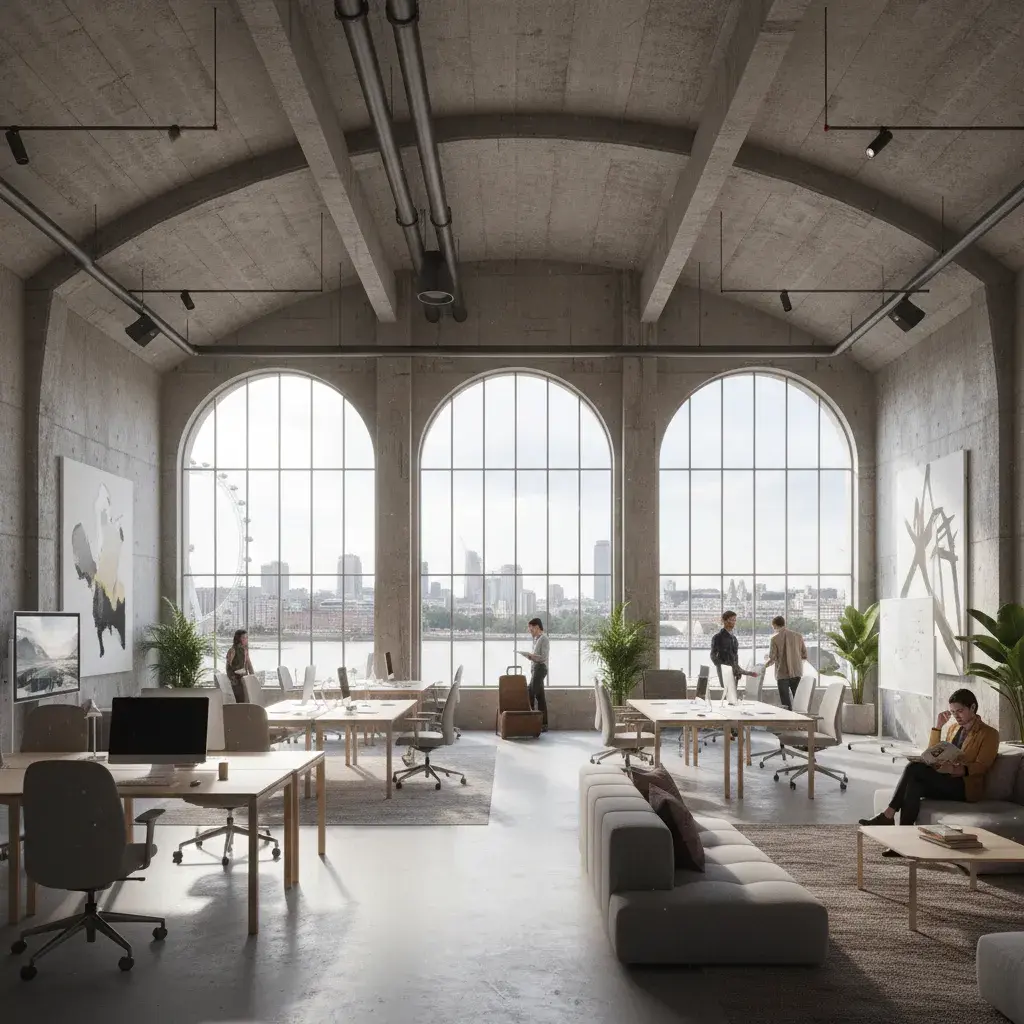
A Waterloo and South Bank visualisation package typically covers public-realm integration, cultural frontage and interior spatial quality. Useful deliverables include station-edge streetscape photomontages, active-frontage studies at dusk, cultural venue interiors, and massing diagrams for the Waterloo Opportunity Area. Each visual is scoped to support a specific decision, from planning sign-off to investor or tenant engagement.
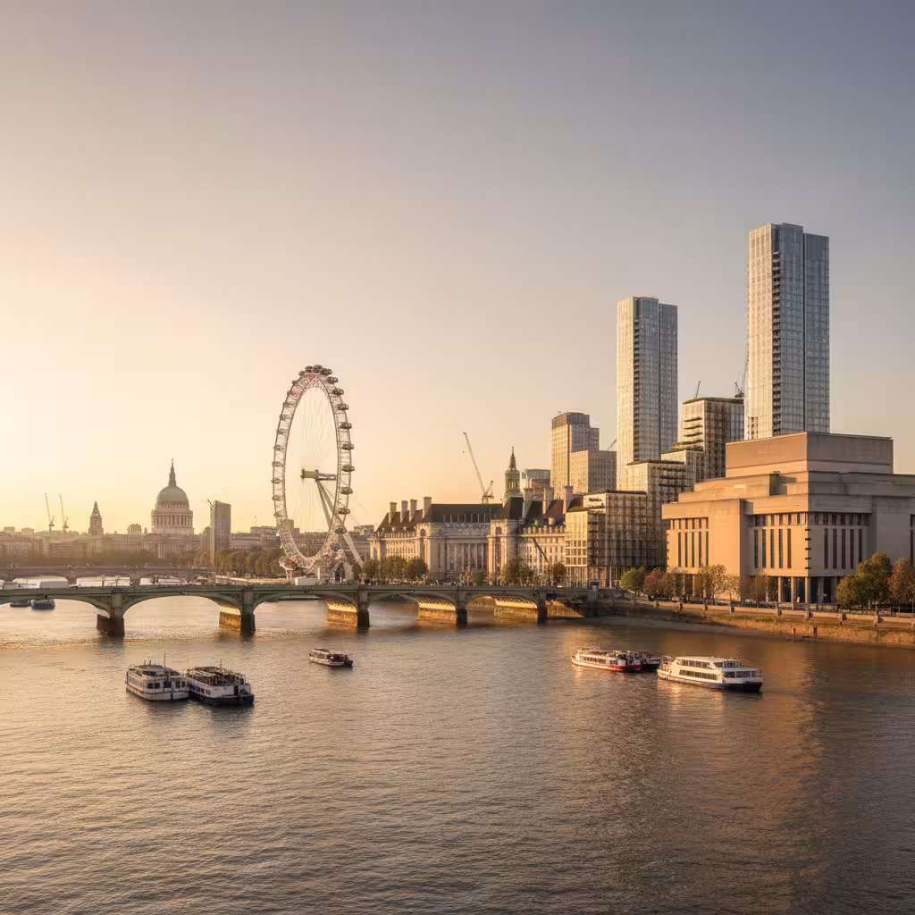
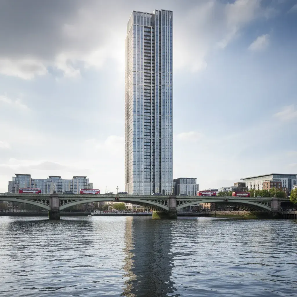
Vauxhall and the Albert Embankment represent the borough's primary tall-building growth area, sitting within the Vauxhall, Nine Elms and Battersea (VNEB) Opportunity Area. This area has the potential for 18,500 new homes and 18,500 new jobs by 2041. Visualisation briefs here are frequently defined by height, skyline impact and riverside townscape sensitivity. The requirement is for accurate, evidence-led verified views (AVR) that anchor the new massing to its surveyed London context.
The workflow diagram traces the process from tall-building massing and viewpoint scoping through surveyed photography and camera matching to final AVR reporting. For projects in Vauxhall, the methodology must be robust enough to withstand design review and possible Mayor of London referral. The CGI evidences the project's relationship to the Thames, the Vauxhall cluster and protected vistas of the Palace of Westminster and Whitehall.

A riverside terrace view at a Vauxhall residential tower captures the character and views a future owner will value. By showing the modern material detail of the building alongside the wider Thames and London Eye context, the CGI bridges the gap between technical planning evidence and premium residential marketing. We deliver these integrated visual packages for tall-building, hotel and mixed-use briefs across the Vauxhall and Albert Embankment corridor.
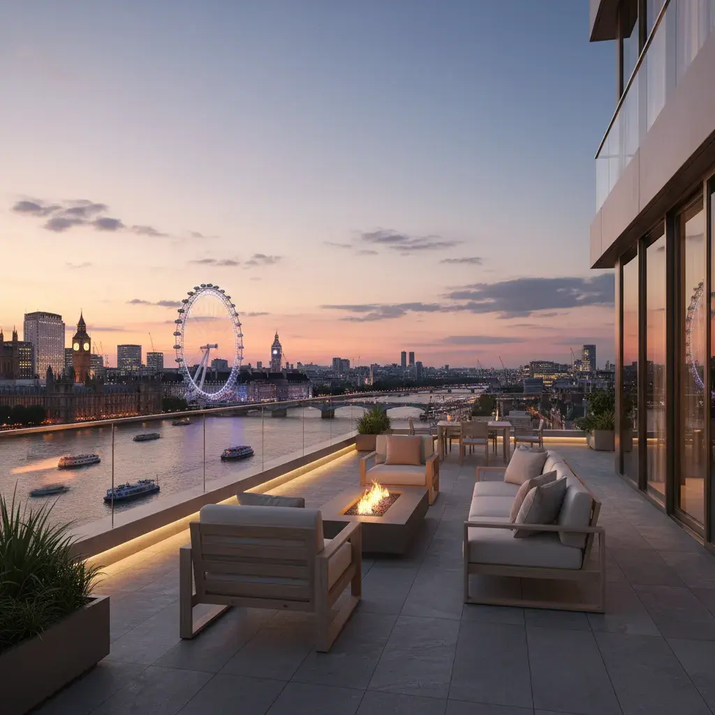
Vauxhall tall-building packages typically include verified views (AVR Type 0-3), riverside photomontages, and residential or hotel lobby and terrace CGI. The goal is to provide a complete visual narrative that addresses both the planning authority's townscape concerns and the developer's commercial objectives. Each image set is built around the specific receptors—bridges, riverside paths or protected vistas—that the planning consultant has flagged.
Lambeth visualisation services align with the project stage: from verified views for tall-building planning routes to interior CGI for cultural workspace and high-end residential marketing.
Lambeth Council planning images for design-and-access support, public consultation, committee packs and material studies.
Discuss this service Verified ViewsAVR, verified-view and photomontage support for tall-building, riverside, VNEB and townscape-sensitive Lambeth sites.
Discuss this service Commercial DevelopmentsCommercial, cultural, workspace, hospitality and mixed-use CGI for South Bank, Waterloo, Vauxhall and Brixton.
Discuss this service Exterior RenderingsFacade, street-scene, public-realm and masterplan views for Lambeth high streets, estates and waterfront plots.
Discuss this service Interior VisualisationsInterior CGI for cultural lobbies, workspace, hospitality, show apartments and design sign-off across Lambeth.
Discuss this service House ExtensionsRear extensions, roof alterations and townhouse or terrace visuals for Kennington, Clapham, Stockwell and Brixton homes.
Discuss this serviceWaterloo and Vauxhall teams need evidence-led images that explain massing, townscape effect and verified-view assumptions clearly.
Mixed-use and residential briefs in Brixton, Waterloo or Vauxhall need believable street-life and public-realm visuals for consultation and marketing.
Kennington, Clapham and Stockwell owners use CGI to decide extension form, roof changes and material tone before planning or construction.
Lambeth CGI is evaluated on its ability to show how new massing sits within iconic riverside, cultural or high-street contexts. Material tone, active frontage and public-realm quality are key reviewers' priorities. For facade, roofline and streetscape visibility, see exterior rendering support.
A Lambeth visualisation programme starts by identifying the planning or commercial decision the images need to support, then matching the viewpoint method and model detail to that goal.
Review the Lambeth address, planning route, drawings, photos, viewpoint requirements and deadline.
Agree the visual purpose: Waterloo planning explanation, Vauxhall verified-view support, Brixton consultation or Kennington design review.
Model the existing and proposed condition with enough Lambeth street, river or cultural context for the decision to read clearly.
Compose the camera positions—skyline, riverside, street-level or interior—before final rendering.
Apply material, light and Lambeth-specific context, then deliver final print-ready and web-optimised files.
Tell us where the Lambeth project is, what stage it has reached, which drawings or references are ready, and whether the images need to support planning, verified views, consultation or marketing.
You can also email drawings, image references and deadlines to hello@architecturalvisualisationlondon.uk.
A useful Lambeth quote starts with the address, planning route and image use: a Waterloo cultural venue, a Vauxhall tower and a Kennington terrace all need different evidence.
Send drawings and references for a brief review and we will confirm the right visual route before quoting.
Nearby borough links connect Lambeth to the wider central and south London growth corridors.
Southwark shares South Bank, Waterloo and Vauxhall planning logic with Lambeth, especially for public-realm, cultural, riverside and townscape-sensitive visualisation.
Westminster sits directly across the Thames, making river views, skyline context and verified-view logic a shared consideration for many Lambeth briefs.
Wandsworth shares the Vauxhall, Nine Elms and Battersea (VNEB) Opportunity Area with Lambeth, where large-scale residential and mixed-use regeneration defines the visual task.
Kensington and Chelsea connects through the western edge of the borough with a shared demand for high-end residential and conservation-area visualisation.
Not every Lambeth application needs verified views. Tall-building proposals in Vauxhall or Waterloo, prominent riverside schemes and sensitive conservation-area projects may need AVR or photomontage support agreed with the planning consultant.
Yes. CGI can show public-realm integration, cultural frontage, interior spatial quality and the relationship to iconic South Bank landmarks for planning, consultation or marketing.
Useful visuals include rear-extension CGI, roof-change studies, material samples and existing-and-proposed photomontages that show conservation-area fit clearly.
The Vauxhall, Nine Elms and Battersea (VNEB) Opportunity Area targets significant growth. Visualisation briefs here typically focus on tall-building scale, skyline effect, public-realm benefit and riverside context.
Typical inputs include the site address, drawings, site photos, viewpoint requirements, planning notes, material references, image use and deadline.