Prime Authority
Specialized in the ultra-prime residential fabric of Kensington, Chelsea, and Notting Hill.
Specialized in the ultra-prime residential fabric of Kensington, Chelsea, and Notting Hill.
Accurate material and detail studies for RBKC’s 38 conservation areas and 4,000 listed buildings.
Verified views and basement studies (CL7) prepared for the highest level of planning scrutiny.
Royal Borough of Kensington and Chelsea submissions often need visuals that make scale, materials and street context easy to understand.
Royal Borough of Kensington and Chelsea projects often need visual material that respects conservation-area character, listed-building fabric, garden-square settings and high private-client expectations. We translate those RBKC conditions into the right service mix, whether the brief calls for architectural visualisation, architectural CGI, property CGI, planning visuals, 3D rendering or verified-view support.
CGI and 3D rendering are most useful in Kensington and Chelsea when a proposal needs to make a precise decision visible: how a townhouse extension meets period fabric, how a basement or lightwell feels, how a mews facade reads in a narrow street, how property CGI drives marketing, or how a prime interior specification will work before procurement.
Interior and exterior property CGI for Chelsea, Kensington, Holland Park and Notting Hill homes.
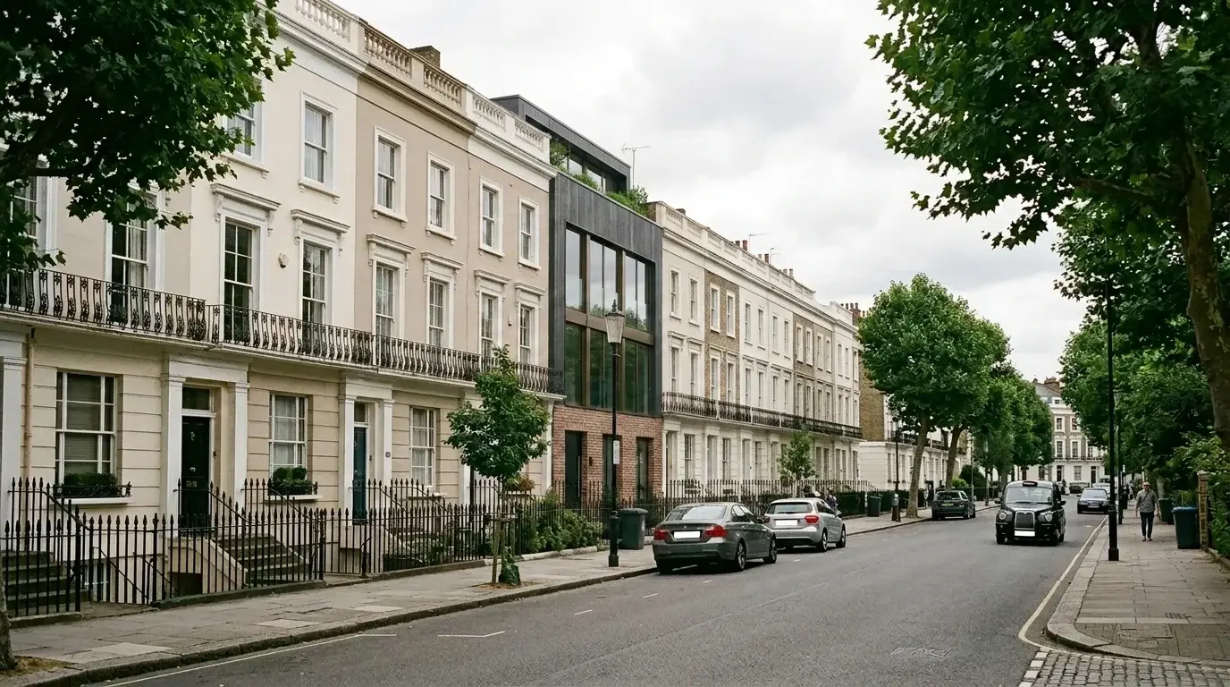
Architectural CGI and material studies for terraces, garden squares and heritage-sensitive streets.
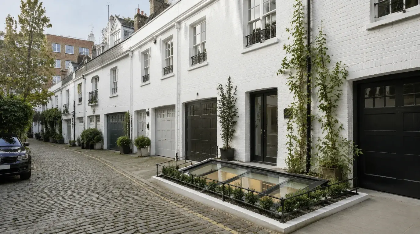
3D rendering for rear extensions, mansards, lightwells, basements and mews changes.
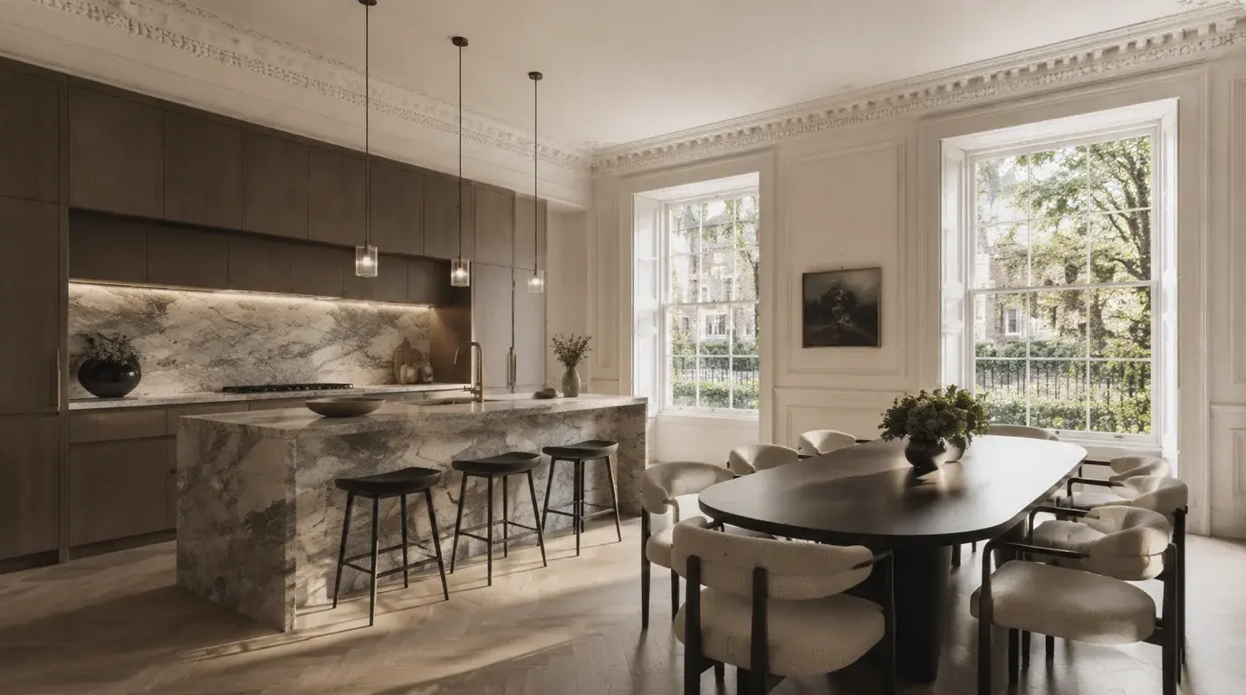
Finish, joinery, lighting and FF&E visualisation before procurement or client approval.
Annotated planning visuals for design statements, consultation packs and RBKC planning presentations.
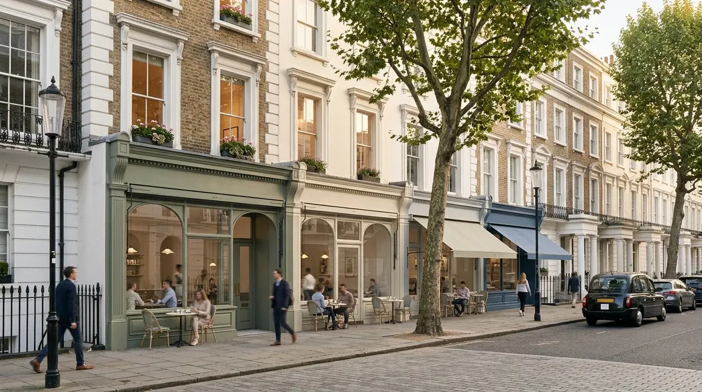
Frontage, arrival and interior visuals for King’s Road, Brompton and South Kensington sites.
For Royal Borough of Kensington and Chelsea submissions, planning visuals should sit alongside the RBKC Local Plan, the relevant Article 4 Directions, the conservation area appraisal and any townscape and visual impact assessment (TVIA) or landscape and visual impact assessment (LVIA) the project team has scoped. We produce imagery for design and access statements, heritage statements, consultation packs, material studies, streetscape views, daylight and sunlight illustrations (BRE 209), interior sign-off, photomontage-style planning visuals, and verified views or AVR coordination when the planning case needs a stricter visual method.
Verified views are essential for Kensington and Chelsea sites where conservation-area character, listed-building settings or development scale is central to the planning argument.
The need is normally set by the planning consultant, project team or authority requirements. Prominent extension proposals, roof additions and heritage-sensitive changes should be reviewed early.
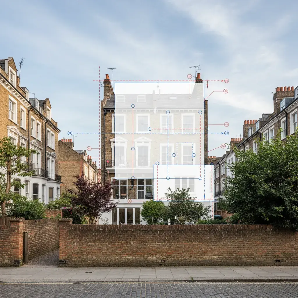
The first view acts as the surveyed AVR baseline: the existing Kensington and Chelsea street scene is held in the agreed camera position, with the proposed-development zone, viewpoint information and facade callouts marked for review. The second keeps the same view and annotation logic, then visualises a contemporary facade intervention within the conservation-area terrace so the planning team can compare existing context and proposed change directly.
For teams comparing routes, planning application visuals can cover design explanation and committee-pack imagery, while verified views are scoped when the viewpoint, survey relationship and methodology need to be documented.
For Kensington and Chelsea projects that take the verified-view route, the methodology runs through four stages: viewpoint scoping, surveyed photography, camera matching against the 3D model, and final photomontage or AVR reporting.

Relevant references include Landscape Institute Technical Guidance Note 06/19: Visual Representation of Development Proposals, Royal Borough of Kensington and Chelsea planning guidance. If the K&C brief may need AVR, agree the visual route before photography and viewpoint selection are fixed.
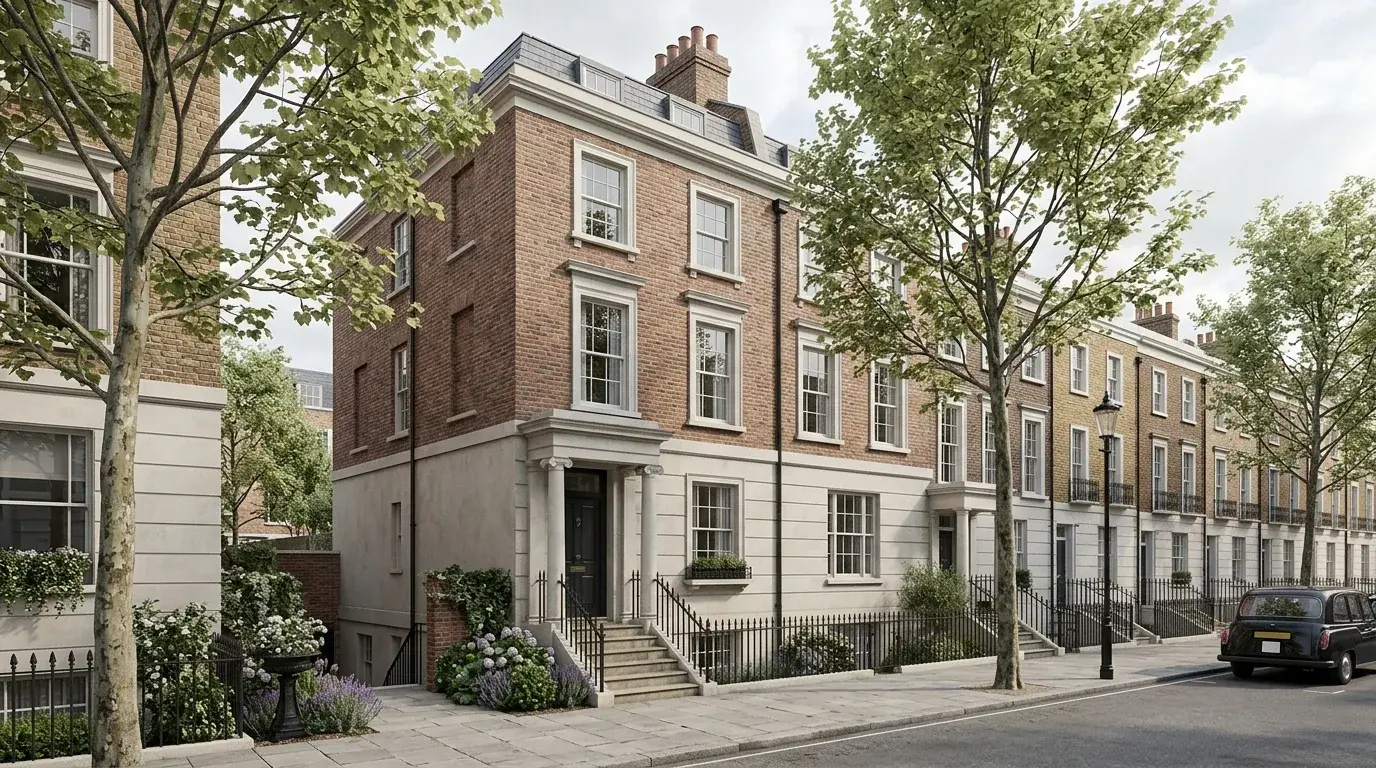
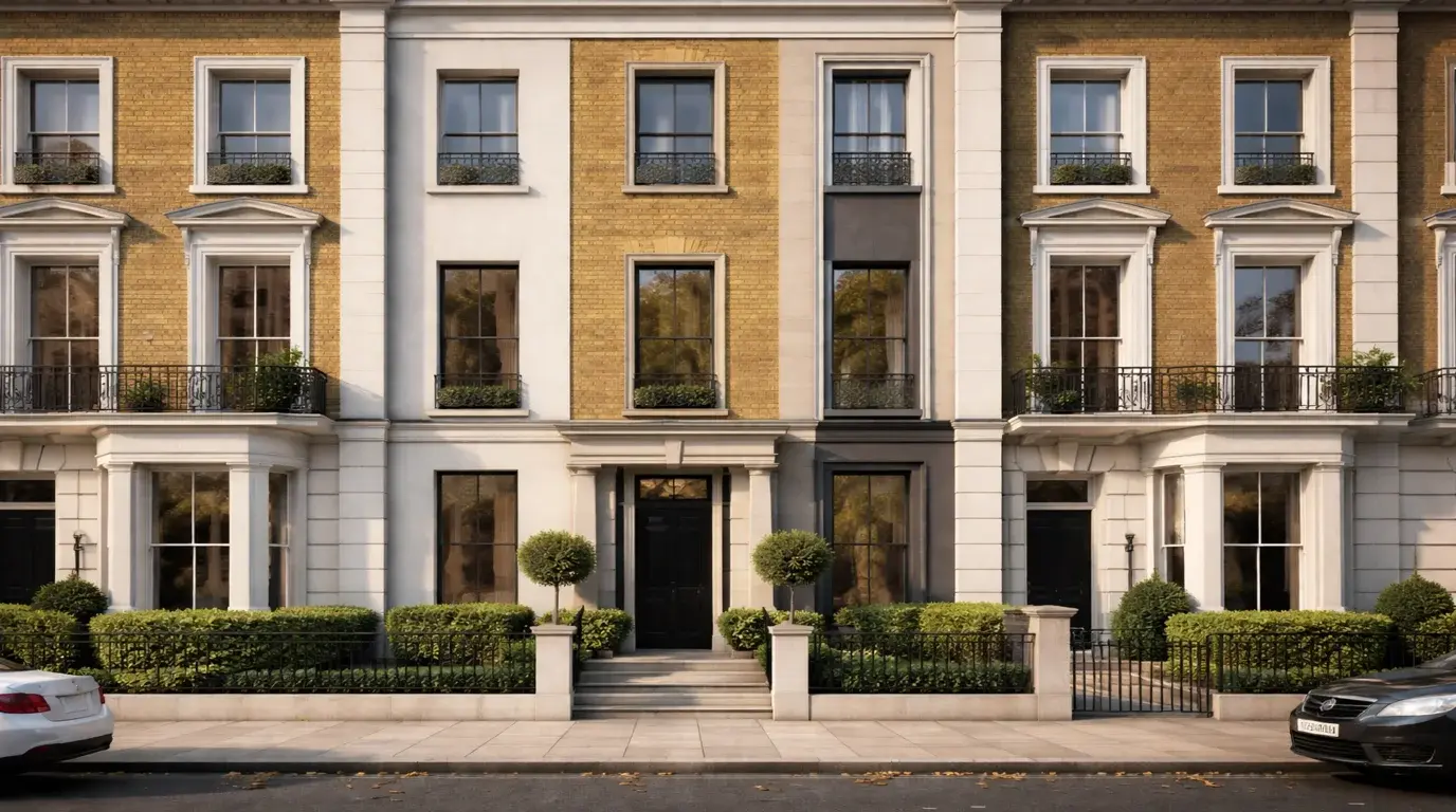
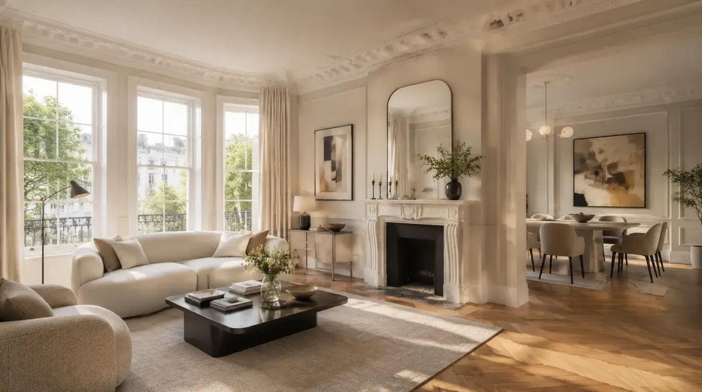
Kensington and Chelsea briefs often sit between planning sensitivity and exacting design taste. The borough contains stucco terraces, garden squares, mansion blocks, mews houses, retail frontages, cultural institutions and premium interiors that each need a different visual approach.
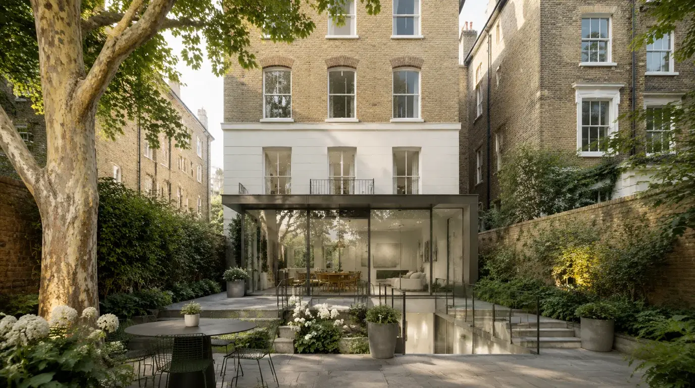
Show room proportion, retained period details, rear additions, garden rooms, basements and finish choices while keeping the terrace or garden-square context clear.
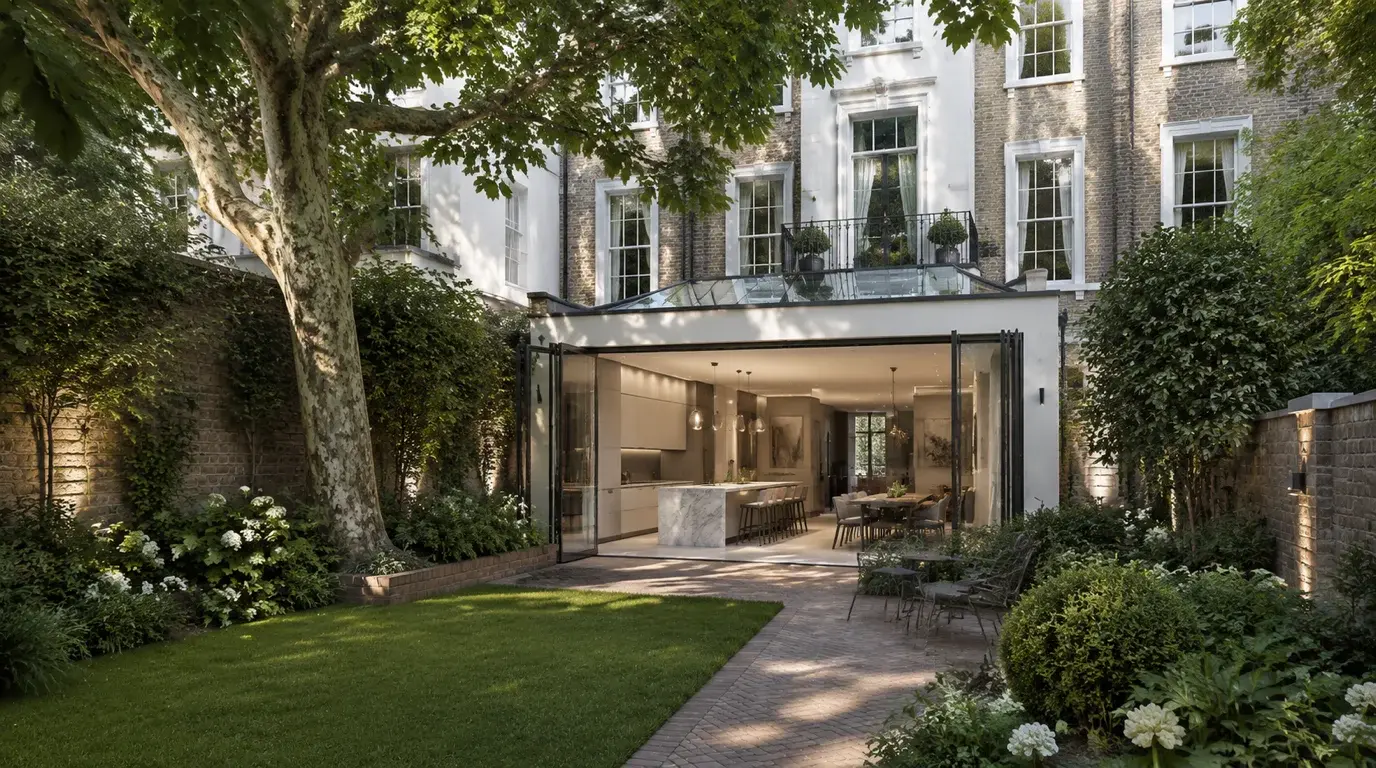
Test kitchen extensions, garden connections, lightwell changes, joinery, lighting and softer residential atmosphere before planning, procurement or client sign-off.
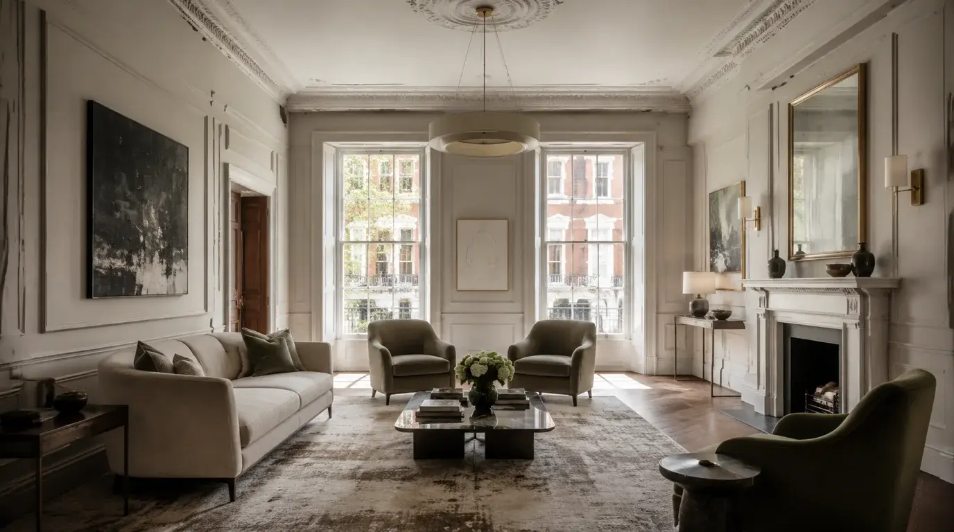
Communicate premium finishes, circulation, lighting, joinery, bathroom and kitchen specification before costly procurement decisions are fixed.
Explain massing, window relationships, lower-ground light, courtyard quality and neighbour amenity where plans alone can feel abstract. RBKC basement schemes also need to read against Local Plan Policy CL7 and the Basement Impact Assessment (BIA), so the CGI should sit alongside the engineering and daylight evidence rather than replace it.
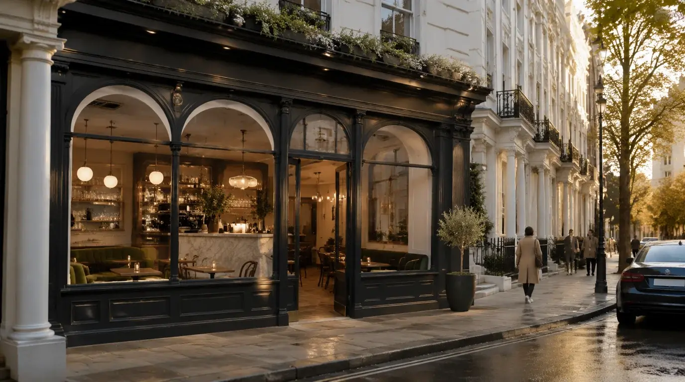
Present frontage, signage, lighting, seating, arrival sequence and interior experience without ignoring the street’s conservation or commercial context.
Compare stucco, brick, stone, glazing, metalwork, planting and lighting choices against existing facade rhythm and adjacent heritage character.
Six services match Kensington and Chelsea projects: interior visualisations, exterior renderings, planning application visuals, house extensions, verified views and residential developments. Choose by what the image must do: private-client sign-off, RBKC submission, marketing pack or AVR documentation.
Prime residential interiors in Chelsea, Kensington, Holland Park and South Kensington, with accurate finishes, lighting, joinery, art and FF&E direction.
Discuss this service Exterior RenderingsFacade, roofline, garden-square and mews views where conservation character and neighbour context affect design perception.
Discuss this service Planning Application VisualsContext images, material studies and photomontage-style planning visuals for Royal Borough of Kensington and Chelsea submissions.
Discuss this service House ExtensionsRear, basement, mansard, lightwell and garden-room proposals where period fabric, daylight and neighbour relationships must be clear.
Discuss this service Verified ViewsAVR and verified-view support for sensitive townscape settings, listed-building surroundings and larger planning programmes where methodology needs early coordination.
Discuss this service Residential DevelopmentsProperty CGI, marketing imagery and planning visuals for premium apartment, mansion-block and boutique residential schemes across the borough.
Discuss this serviceNeed clear planning, conservation and material visuals that explain design intent without over-selling the proposal.
Need believable finish, lighting, joinery and FF&E imagery before fixing expensive specification choices.
Need premium, credible property CGI and marketing visuals that still respect the borough context and buyer expectations.
Kensington and Chelsea CGI needs to show more than surface finish. Viewpoint choice, facade rhythm, lightwell depth, joinery detail, material credibility, neighbour context and retained period fabric all affect whether the image equips the project team to decide with confidence. For facade, roofline and streetscape visibility, see exterior rendering support.
The process starts with drawings, site context and intended image use, then locks the visual purpose before modelling. That anchors outputs to RBKC planning review, private-client sign-off, investor presentation or sales imagery rather than producing generic renders.
Review drawings, planning context, site photos, finish references, deadlines and intended image use.
Agree the visual purpose: planning explanation, private-client sign-off, procurement confidence, sales imagery or consultation support.
Model the existing and proposed condition with enough surrounding context for the Kensington and Chelsea setting to read clearly.
Compose street, interior, garden, lightwell, material or planning viewpoints before final rendering.
Apply materials, lighting, furniture direction, facade detail and borough-specific context, then deliver print-ready and web-optimised stills or iterations.
Tell us where the project is, what stage it has reached, which drawings or references are ready, and whether the images need to support RBKC planning, private-client sign-off, procurement or marketing.
You can also email drawings, image references and deadlines to hello@architecturalvisualisationlondon.uk.
A clear Kensington and Chelsea quote depends on the site, building sensitivity, intended image use and the decision the visuals need to support.
Send drawings and references for a brief review and we will confirm the right visual route before quoting.
Where Kensington and Chelsea projects sit on the map
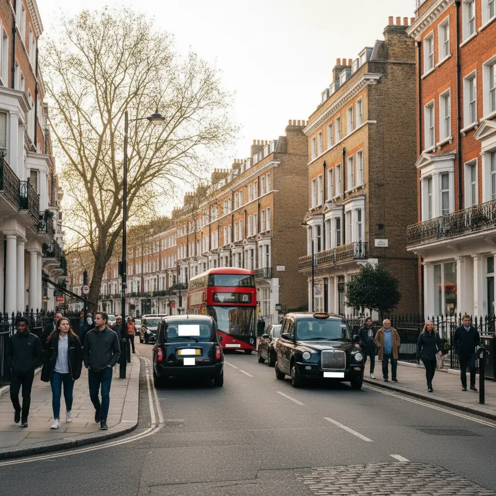
The Royal Borough of Kensington and Chelsea is the smallest London borough by area at roughly 12 square kilometres. Its southern edge runs for about 4.5 kilometres along the north bank of the River Thames, from Chelsea Harbour in the south west to the Westminster boundary near Chelsea Bridge. The eastern edge follows the Earls Court Road and Cromwell Road corridor up to South Kensington, the western edge runs along Holland Road and Latimer Road against Hammersmith and Fulham, and the northern edge meets Westminster around Westbourne Grove and Notting Hill.
Districts sit in three broad bands. The southern band covers Chelsea, World’s End and the Royal Hospital Chelsea (Wren, Grade I) along the river. The central band runs from Kensington and Kensington High Street through to South Kensington and the museum quarter (Natural History Museum, Victoria and Albert Museum, Science Museum). The northern band stretches from Holland Park east through Notting Hill to Ladbroke Grove. Each band carries its own building stock: stucco terraces and embankment houses in the south, palatial townhouses and mansion blocks centrally, painted stucco terraces and mews houses to the north.
Heritage and conservation density is exceptional. The borough holds 38 conservation areas covering nearly three quarters of its land, including the Ladbroke Conservation Area which is one of the largest in London at around 440 acres. Listed buildings number close to 4,000 across Grade I, Grade II* and Grade II. Almost any Kensington and Chelsea visualisation brief will sit inside a conservation area, adjacent to a listed building, or visible from a London View Management Framework Designated View, so the relevant Conservation Area Appraisal and Local Plan policies should be read before the visual route is fixed.
Geographic register shapes the visualisation work directly. Notting Hill, Ladbroke Grove and the Kensington garden squares concentrate basement and lightwell briefs subject to Local Plan Policy CL7. Chelsea, the Embankment and the Royal Hospital setting concentrate listed-building and heritage-statement briefs. South Kensington concentrates premium interior, mansion-block and museum-adjacent townscape briefs. Verified views and Townscape and Visual Impact Assessments are most often needed in the central and southern conservation cores; illustrative CGI and material studies remain useful across all three bands for design review and private-client sign-off.
Nearby borough links extend Central and West London project context for Kensington and Chelsea briefs.
An AVR is a visualisation prepared to the Landscape Institute Technical Guidance Note 06/19, with a documented relationship between the surveyed photograph, camera position, 3D model and proposed scheme so a planning officer can rely on it as evidence. A Kensington and Chelsea project usually needs an AVR rather than illustrative CGI when the proposal materially affects townscape, the setting of a heritage asset, a London View Management Framework view, a conservation-area roofline, or neighbour amenity in a sensitive setting. The Royal Borough planning consultant or design team typically sets the requirement at pre-application stage.
TGN 06/19 defines four visualisation types of increasing rigour. Type 1 is an annotated photograph that identifies the proposed location and visibility envelope without 3D modelling. Type 2 overlays a wireline or wireframe model on the surveyed photograph to show scale, position and form. Type 3 is a rendered photomontage or photowire that integrates material, lighting and context. Type 4 is a fully verified view, prepared with surveyed camera control, ground points and a registered 3D model so the geometry is scale-verifiable. The right type for a Kensington and Chelsea scheme is set by the planning consultant against the sensitivity of the view.
A TVIA is normally required when a Kensington and Chelsea scheme is large enough or visually sensitive enough that the planning officer needs structured evidence of townscape and visual effects. In RBKC that often covers schemes within or adjacent to a conservation area, near a listed building, visible from a London View Management Framework Designated View or Protected Vista, or affecting a sensitive roofline. The TVIA scope, viewpoints, receptors and methodology should be agreed with the planning consultant and townscape consultant at pre-application, with verified views or AVR Type 4 commissioned only after the viewpoint set is fixed.
Local Plan Policy CL7 is the Royal Borough of Kensington and Chelsea policy that controls residential basement development, supplemented by the Basements SPD adopted in April 2016. CL7 limits basement extent (typically a single storey), restricts construction beneath listed buildings, requires retention of garden ground and trees, and requires a Basement Impact Assessment from a chartered engineer covering ground, water, structure and construction logistics. CGI for a CL7 scheme should sit alongside the BIA, daylight and sunlight study and arboricultural report, showing the lightwell, garden loss, tree retention, neighbour amenity and street-facing character impact accurately rather than replacing the engineering evidence.
In practice almost every meaningful basement in Kensington and Chelsea needs full planning permission. RBKC made a borough-wide Article 4 Direction in April 2015 that removed permitted-development rights for basement extensions to single dwelling houses across the entire borough, in force from 28 April 2016, and Basement Policy CL7 imposes further controls. Households with listed buildings or properties inside conservation areas already lacked permitted-development scope for most basement work. Any CGI commissioned for a Kensington and Chelsea basement should therefore be scoped from the start as planning evidence, not as illustrative-only marketing.
A photomontage is a CGI composited into base photography to show a proposed scheme in a real London context. A verified view is a photomontage produced to AVR Type 4 methodology, with surveyed camera position, lens-matched photography, ground control points and a registered 3D model so the geometry is scale-verifiable rather than illustrative. Every verified view is a photomontage, but not every photomontage is verified. For Kensington and Chelsea heritage and townscape submissions, planning officers usually want the verified-view route on sensitive viewpoints and accept illustrative photomontage only on lower-sensitivity views or for design-stage discussion.
Cost varies with the technical rigour and evidence standard required for the intended use. Illustrative interior and exterior CGI views are quoted per package, while Accurate Visual Representations (AVR) and verified views with surveyed control reflect the additional survey, camera-matching, and reporting requirements. Final fees depend on viewpoint count, model complexity, townscape context requirements, and the specific planning or marketing decision the visuals need to support. Send the drawings and viewpoint brief and we will provide a bespoke quote against the actual scope.
A verified view needs surveyed camera positions captured by GNSS or total station, base photography taken with a lens whose focal length matches the assessment requirement (TGN 06/19 specifies a 50mm equivalent for Type 1 single-frame views), the project 3D model in a coordinate system registered to the survey, and a set of OS or LIDAR context data to lock building lines and ground levels to the real world. Photography should be taken in agreed light and weather conditions, ideally at the time of year and time of day relevant to the planning argument. For Kensington and Chelsea views inside the LVMF, viewpoints and methodology should be agreed with the planning consultant before the photographer goes to site.
The Royal Borough of Kensington and Chelsea operates several Article 4 Directions including a borough-wide direction on basement extensions to single dwelling houses (made 15 April 2015, in force 28 April 2016), directions on demolition in conservation areas, and a Class E to C3 commercial-to-residential change of use direction made 20 July 2021 and modified by the Secretary of State on 22 July 2022. An Article 4 Direction removes permitted-development rights, so a project that would normally proceed without planning permission elsewhere may need a full application here. CGI for an Article 4 site usually has to be commissioned earlier and at higher fidelity, framed as planning evidence with conservation-area and heritage-setting context rather than as marketing imagery.
A heritage statement is the document that assesses how a proposal affects the significance and the setting of a heritage asset, and is normally required for listed-building consent and for any Kensington and Chelsea application that affects a listed building or its setting. The CGI should visualise the same alterations the heritage statement describes, using the same fabric vocabulary (retained, repaired, replaced, new intervention), so the planning officer can read the two documents together. We recommend producing the visuals after the heritage statement is drafted, so the imagery shows the agreed conservation strategy rather than an earlier design option that the heritage consultant later changed.